

People who turned out for the public hearing on the U.S. 31 project Monday were overwhelmingly concerned about the impact the project will have on Franklin.
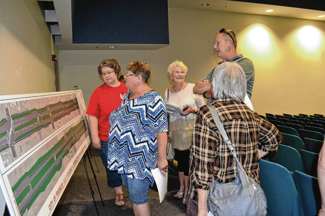
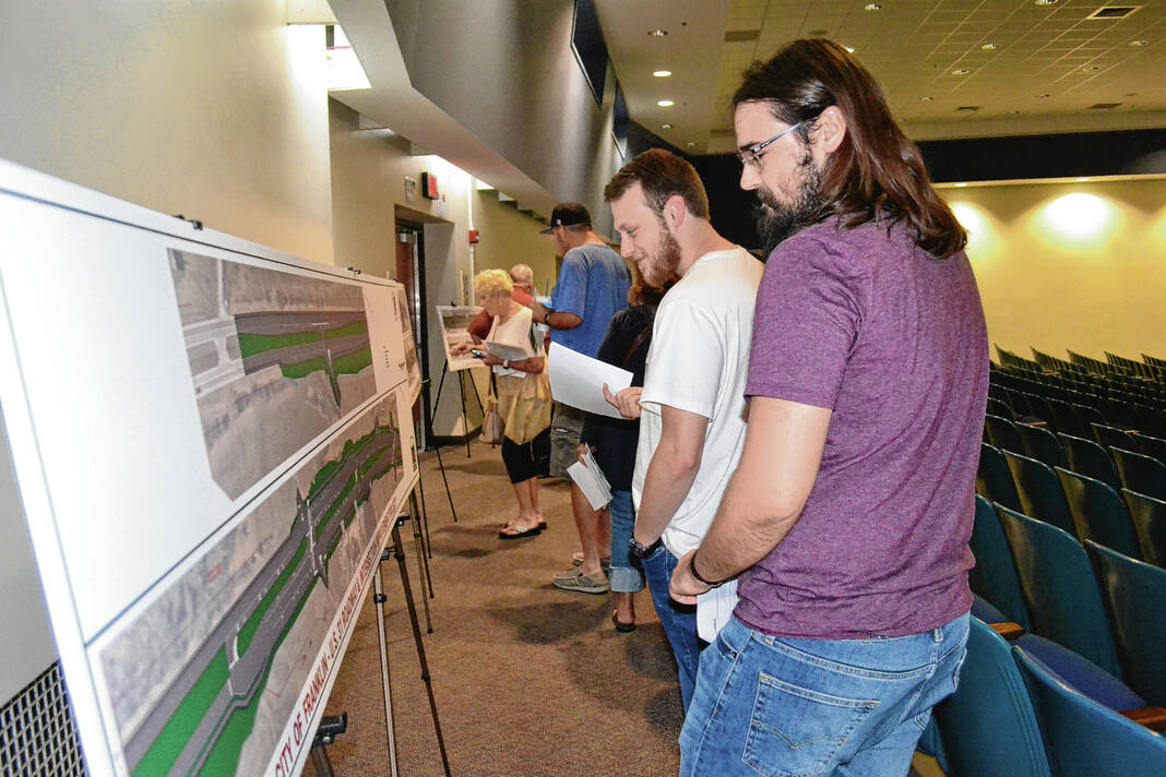
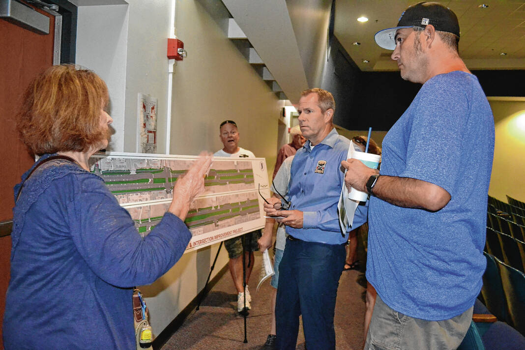
Local residents and business leaders gathered at the Franklin Community Middle School Auditorium to give input Monday on an over $42 million project that would bring an entirely new streetscape featuring several types of reduced conflict intersections and multi-use paths to the five-mile stretch of U.S. 31 in Franklin.
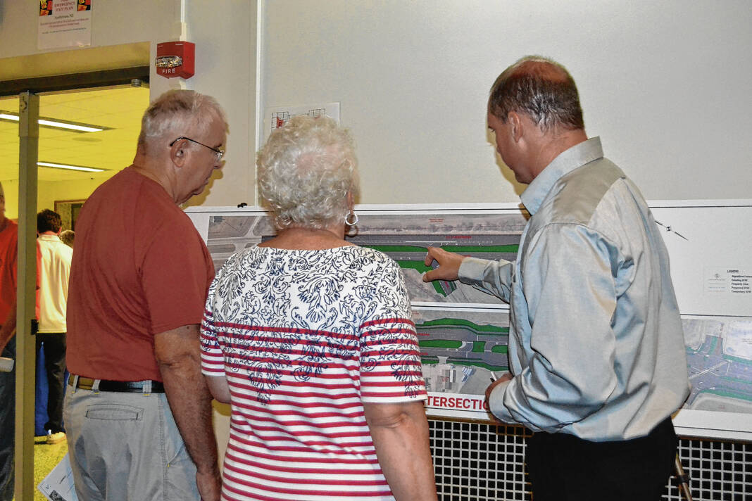
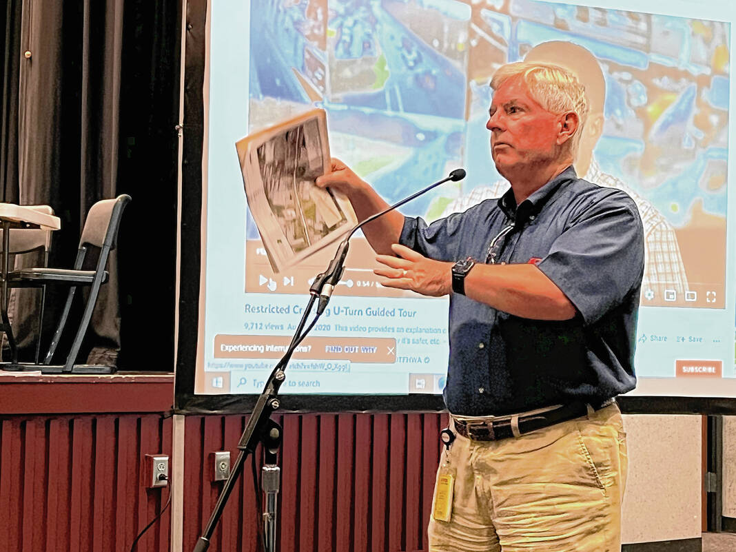
The Indiana Department of Transportation, CrossRoads Engineers and SJCA Inc. hosted the public hearing to provide an opportunity for the public to learn more about the project, view more detailed renderings of the project, ask questions and provide official comments to the project team.
What’s changing
The purpose of the project is to reduce congestion, improve traffic flow, improve pedestrian connectivity and increase safety along U.S. 31 in Franklin, INDOT officials say.
The project would remove the ability to cut directly across U.S. 31, which state officials say has been the source of many accidents within the corridor. Instead, the project would construct a long series of reduced conflict intersections between South Main Street and the area just north of Israel Lane.
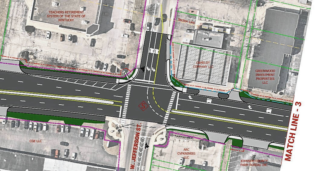
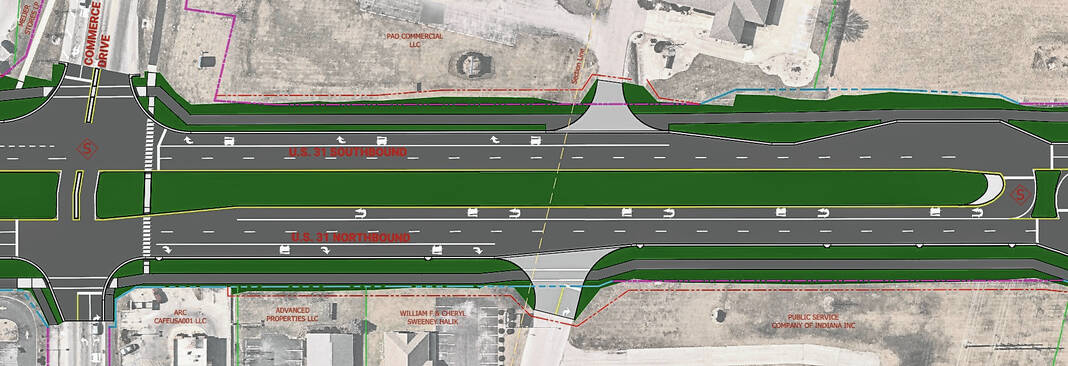
Jefferson Street and Commerce Drive are the only streets that will have cross traffic flowing between all lanes of U.S. 31, due to the volume of traffic those streets have, INDOT officials said Monday.
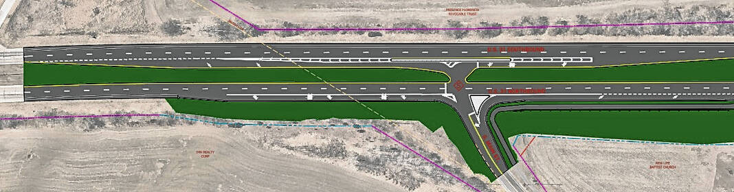
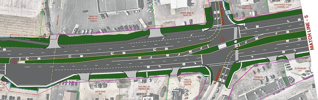
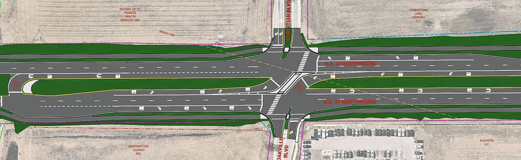
Four types of intersections new to Franklin will be installed to reduce “conflict points” or ways that motorists can get into an accident.
Jefferson Street will be a Partial Boulevard Left Intersection, which means westbound traffic will be able to go straight or turn right, but not left, while eastbound traffic can travel in all directions. Traffic from Jefferson Street that would normally turn left would instead make a U-turn at a signalized crossing near King Street.
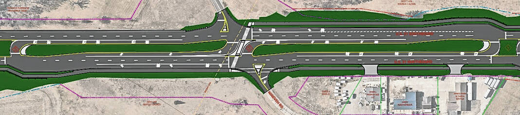
A Continuous Green-T intersection is planned at South Main Street, which means traffic from South Main Street and northbound U.S. 31 would be controlled by a signal, while southbound traffic flows freely, INDOT officials say.
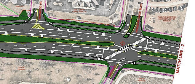
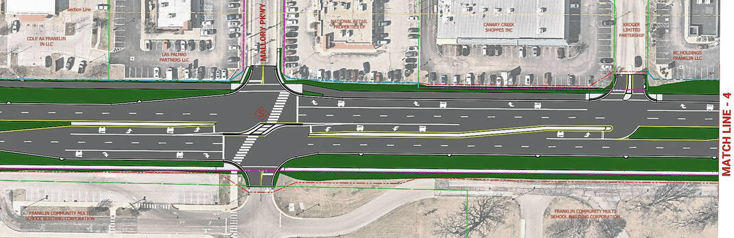
R-CUT intersections will be built at Nineveh Road, Franklin Lakes Boulevard and East South Street, West King Street, Mallory Parkway, Westview Drive and North Main Street, Earlywood Drive, Christian Boulevard and Oakville Boulevard. An R-CUT intersection is designed for all side street movements to begin with a right turn, with side street left-turn and through traffic turning right to make a U-turn at a dedicated downstream median opening.
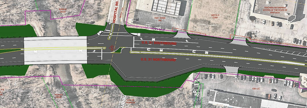
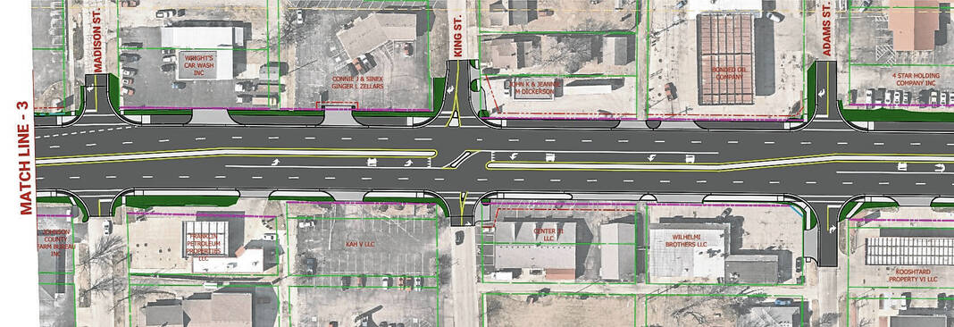
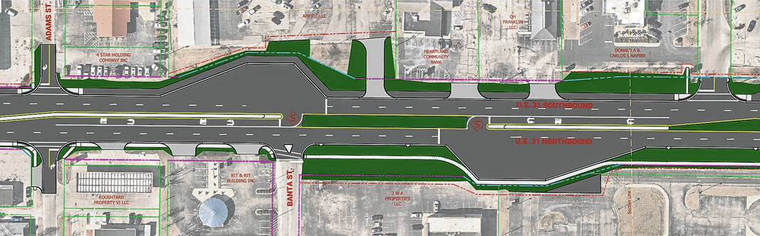
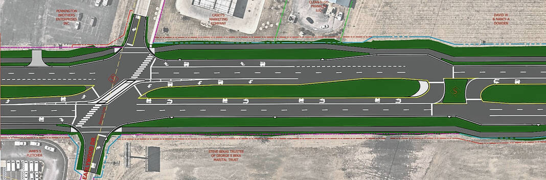
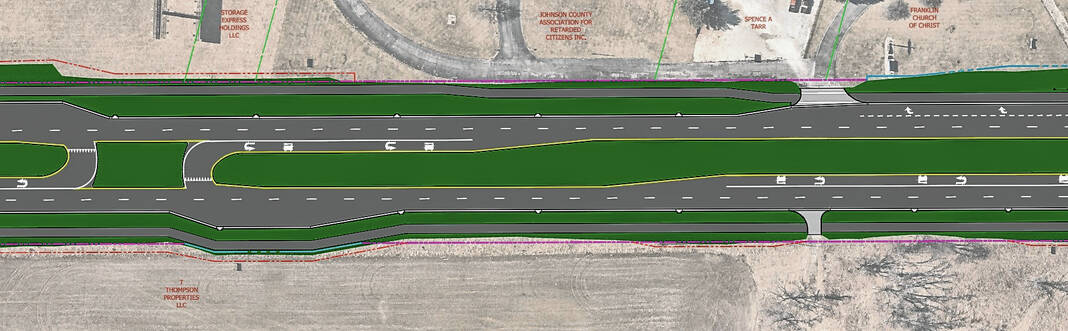
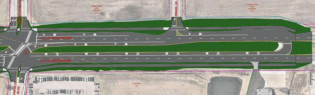
Median U-turn, or MUT, intersections will be installed at West Adams Street, Ironwood Drive, Hospital Road, East Madison Street, Banta Street, Lemley Street, Schoolhouse Road, Cedar Lane, Acorn Boulevard, Ransdell Drive, Simon Road, Commerce Drive, Industrial Drive, Branigin Road, International Drive, Locust Street, Lancer Drive and Sloan Drive, Covington Drive, Paul Hand Boulevard and Israel Lane. A MUT is a type of intersection where left-turn vehicles from one or both roads make U-turns at dedicated median openings to complete the desired movement.
MUT intersections are also being installed at the entrances to Walmart and KYB Americas Corporation to ease the flow of traffic from those highly-trafficked businesses.
Commerce Drive will be a modified MUT, as the intersection design will allow through traffic and right turns, but left-turning traffic will have to make a U-turn in a dedicated, signalized lane a short distance north or south of the intersection.
Many but not all of the R-CUT and MUT intersections will have a traffic signal to control movement from the U-turn lane. Signals are placed at the intersections that INDOT officials expect to be the most highly trafficked.
Some signals that control all lanes of traffic will remain on U.S. 31 but will be reduced in favor of controlling the flow of traffic on one side of the road or controlling flow from the U-tun lane. The signals are being changed to optimize traffic flow, INDOT officials said.
In addition to the intersection changes, a replacement of the box culvert at Canary Ditch is planned, with both bridges on the road to be widened to accommodate a multi-use path. The path will be either a six-foot concrete sidewalk or a 10-foot asphalt trail for the length of the project, INDOT officials say.
The path will be constructed on both sides of the highway and will be accompanied by crosswalks, ADA-compliant curb ramps, and lighting all along the path. Landscaping will be incorporated in select areas, INDOT officials say.
Mayor Steve Barnett last week told the Daily Journal city officials worked closely on the design to further the city’s goals of connecting the retail and residential areas on U.S. 31 to downtown with trails. The trail will run the length of the project and intersect with the city’s current trail system along the way.
A few years ago when the project was being planned, the city council contributed $3.5 million for the engineering of the trails because pedestrian connectivity on U.S. 31 was something that city officials had been working toward for years, Barnett said.
City officials didn’t give input on the design of the road, but Barnett said safety improvements were needed. He’s been told the Franklin stretch of U.S. 31 is the most dangerous area between Indianapolis and Columbus.
The rationale
INDOT officials say while these types of intersections are still relatively new in Indiana, they are proven to reduce accidents, particularly fatal accidents. These types of intersections have been built on U.S. 30 in Allen and Whitley counties, on U.S. 231 in Spencer County and U.S. 41 in Newton County.
Since construction, fatal and injury crashes in those areas have been reduced by an average of 81%, property-damage crashes are down by an average of 58% and all crashes have decreased by an average of 68%, according to data from INDOT. Nationally, statistics show crashes reduce by at least 50% where reduced conflict intersections are installed and fatal crashes decline by as much as 85%.
The reason why these intersections reduce accidents is they reduce the number of potential conflict points where vehicles could collide, INDOT officials explained. Four-direction, signalized intersections have a total of 32 potential vehicle conflict points, with 16 of those being points in the intersection where right-angle, or T-bone and left-turn crashes are possible. However, R-CUT and MUT intersections have many fewer conflict points, at 14 and 12, respectively, INDOT officials said.
An INDOT review of crash history revealed a total of 697 crashes between 2014 and 2016, with 156 of those being personal injury crashes. There were 379 rear-end crashes, 100 right-angle collisions and 75 left-turn accidents.
INDOT arrived at this intersection design through detailed analysis, reviewing data and computer modeling. It was determined through that process that by eliminating left turns and through-movements at most intersections, crashes would be likely to reduce in number and decrease in severity in Franklin.
Last year INDOT shut down a crossing point that was among the most dangerous, Simon Road, by installing barriers that prevent cross traffic. Schoolhouse Road, Christian Boulevard, Paul Hand Boulevard and Westview Drive are other areas of U.S. 31 where accidents occur often, Franklin police data shows.
The intersections are being designed for peak travel times and will be large enough to accommodate large vehicles like semi-trucks. As part of the project, several asphalt aprons called traffic loons are being built where traffic crosses over via a U-turn lane. The traffic loons are placed there to make sure semis can make their turn without damaging the side of the road.
Residents express concerns
Residents had the opportunity to ask officials from INDOT and Crossroads Engineers questions about the project and how it might impact their homes and their ability to access businesses and restaurants along the corridor.
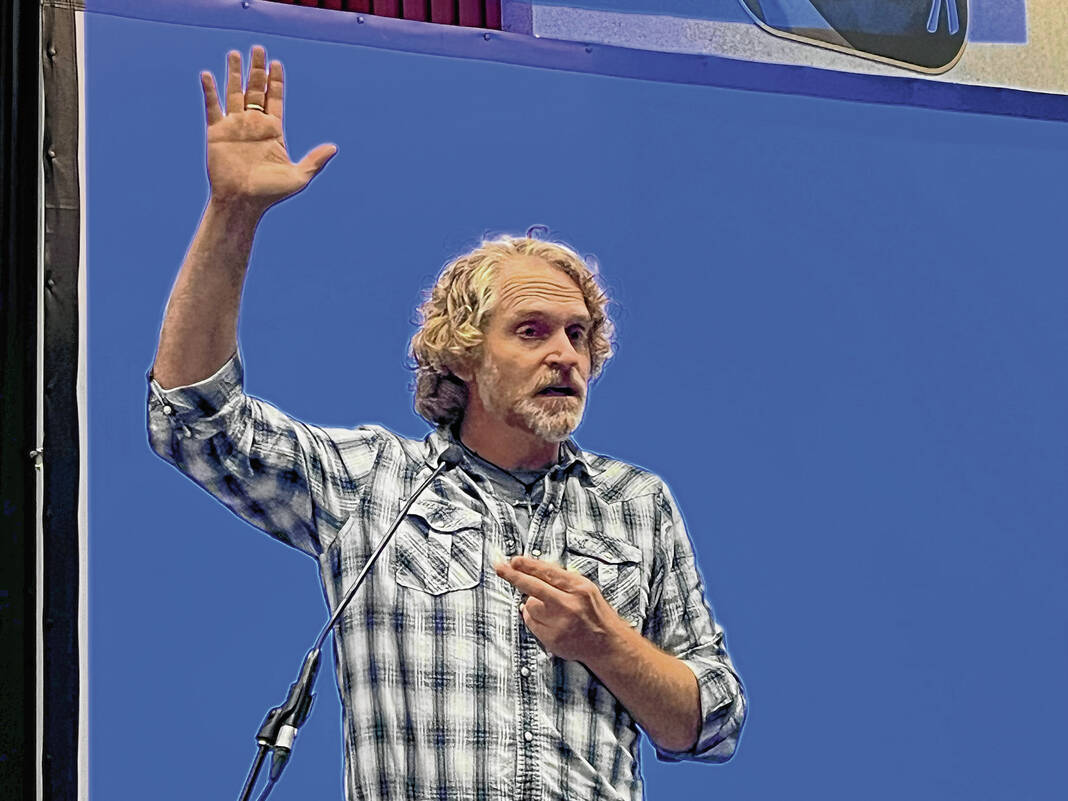
The few dozen residents who spoke publicly at the meeting were opposed to the project for various reasons.
Several church members and leaders from Turning Point Church spoke at the meeting and said they disagree with losing access to cut across U.S. 31. They expressed concerns that the U-turn lanes would cause, rather than solve, a problem with accidents. They didn’t recall any serious accidents in front of their church in recent years.
Lance Clark, vice president of administration and general counsel for KYB, asked INDOT to make sure there is high capacity in the U-turn lane at KYB. He said that will be needed on both sides of the highway to make sure employees get safely to and from work.
Becky Allen, transportation director for Access Johnson County, said the local transportation provider would be challenged by the U-turn lanes. The provider might have to change routes to avoid the U-turns because they encourage drivers to avoid U-turns, she said.
Others were concerned about large vehicles like semis and farm equipment using the U-turn lanes and about whether the U-turn lanes would cause delays for first responders who are on the other side of the highway from a fire or medical emergency.
Melissa Gray, a Franklin Lakes resident who is also the treasurer for Turning Point Church, said this project would cause problems for her no matter where she goes in Franklin.
“Literally every time I leave my house I go straight or I go left and I won’t be able to do that anymore. This is a major frustration for me. Every time I leave my house I will be going the wrong way for a little bit,” Gray said. “I’m from Michigan, I spent the first half of my life there. Michigan lefts are not out of the ordinary, but … we didn’t block through traffic. Making it so you can’t go straight through an intersection just seems ridiculous.”
Many were concerned that the traffic pattern would restrict their access to businesses and services along U.S. 31 and that those businesses might ultimately close. They say the highway also would also cause a rift in the community and could challenge the city’s ‘small town feel.’
“Shopping at all our local businesses, going to the library, downtown, the hospital, the schools; everything that we do in Franklin is now going to be severely restricted and a pain in the butt,” resident Lori Haggard said. “We are going to be like ‘you know what I don’t want to deal with it’ and just stay home. Businesses are going to lose business.”
Parents were also concerned about access to schools along the road, particularly Franklin Community High School. Since hundreds of teenage drivers will have to make a U-turn daily to go to school, they are concerned that will put students in danger.
“I am a parent of a 16-year-old and while we are saying we are taking away left-turns, that U-turn is still a left-turn crossing two lanes of traffic on 31 …” resident Scott Stillabower said. “You are putting it in the hands of these young drivers still to make a choice when to turn and cross two lanes of traffic. I think we are putting young lives in danger at that intersection.”
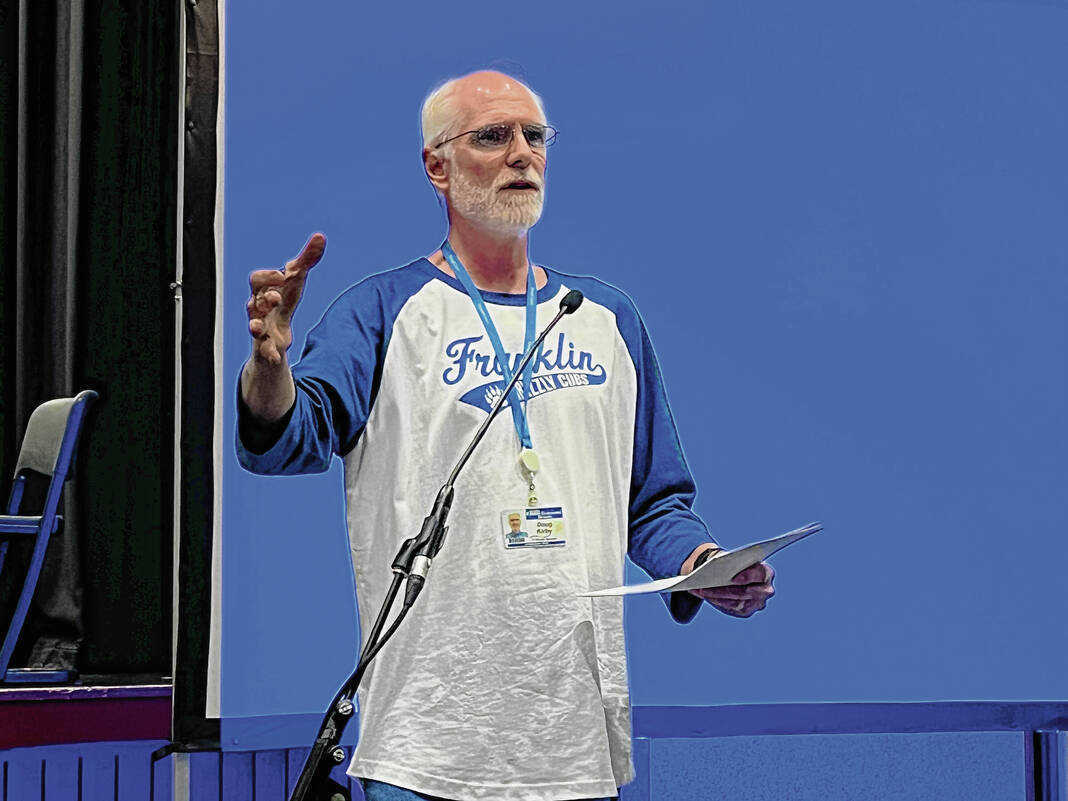
Others like resident Doug Kirby were concerned the method INDOT has chosen is too extreme for the number of crashes at most intersections.
“I’d like to know, in this five-mile stretch, how it was determined that things needed to change the entire way instead of just an intersection or two,” Kirby said. “Yeah, we have a problem at an intersection or two where we have problems. Let’s deal with those.”
Others suggested a cheaper solution of synchronizing the signals better and eliminating a few intersection crossings instead of changing all five miles of the roadway.
Project timeline
Construction is expected to start next spring and be completed in phases over the course of the next two years.
The project will begin with replacing the bridge over Canary Ditch, and in summer 2023 the project will move south to begin reconstructing the road at the southern end of the project, from South Main Street to the bridge over Youngs Creek.
Crews will move north from South Main Street for the duration of the project, with work at the northern part of the project, from Sloan Drive to Israel Lane to begin in summer 2025.
How to comment
Comments and questions may be submitted via email to Victoria Veach with SJCA Inc. at [email protected]. Comments can also be mailed to Veach. at 1028 Virginia Ave., Suite 201, Indianapolis, 46203.
All comments on the project should be submitted by the close of business on Aug. 15.
INDOT will make answers to all questions asked during the meeting or submitted by other means available following the public comment period.
Source: Indiana Department of Transportation


