


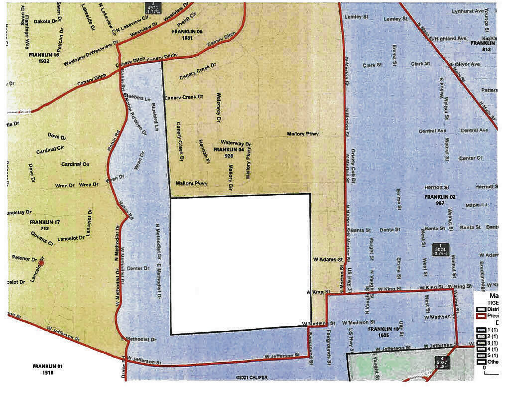
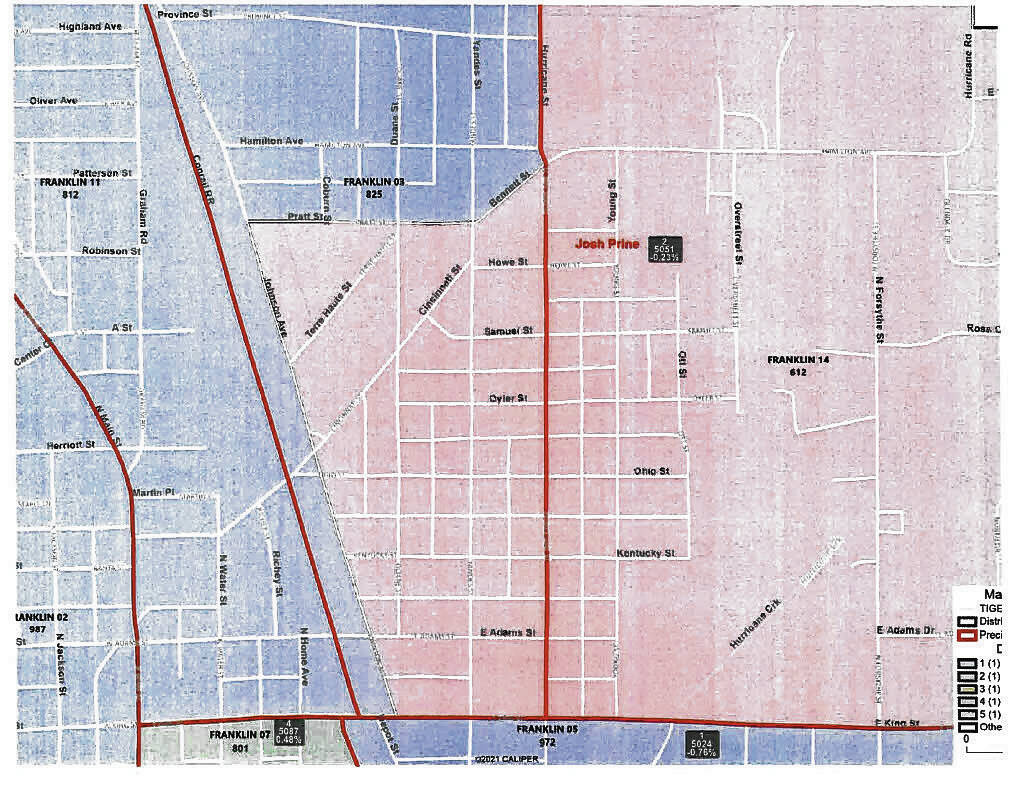
This map shows the proposed boundaries for the Franklin Common Council single-member districts based on the 2020 census numbers. White squares within the districts are unannexed areas or are Johnson County property.
Maps provided by city of FranklinNew maps for Franklin Common Council districts are ready for approval later this month.
The maps are being reworked ahead of next year’s municipal election to reflect changes in population from the 2020 census. The new districts feature some significant changes because of uneven population growth in the last 10 years.
The city hired Indianapolis law firm Kroger Regas and Gardis to help officials through the redistricting process for the council’s five single-member districts. The redistricting plan that was discussed during a public hearing Tuesday was the result of the firm working with Council member Anne McGuinness to establish boundaries that were compliant with state law and the constitution, said Ted Nolting, an attorney with the firm.
Since the city’s population grew by only 1,601 since the last census, the original hope was to keep the boundaries as similar as possible to the current boundaries. However, unevenly distributed population growth and differences in population density of certain precincts forced changes. If these changes had not been made, there would be a standard deviation of 63% between the most and least populous districts, Nolting said.
After splitting four precincts, and adjusting the boundaries other ways, the maps under consideration have a 4.05% standard deviation, he said. That is under the 10% threshold that could trigger a legal challenge to the boundaries, based on legal precedents.
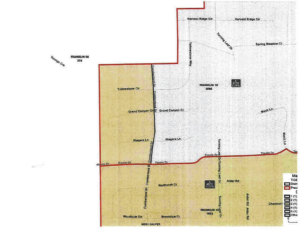
Precincts being split are Franklin 3, 4, 18 and 19.
In the new maps, council District 3 juts into Franklin 19 in the area west of Cumberland Drive, while the area east of the street is in District 5.
Franklin 4 is split because of the Johnson County 4-H Fairgrounds, which is an uninhabited county property, so it is not part of the city’s voting area. The property is surrounded to the west and south by District 1 and to the north and east by District 3.
Franklin 18 is split at Jefferson Street and U.S. 31, with the area south of Jefferson Street and east of U.S. 31 in District 4 and those on the other side of the street in District 1.
Franklin 3 is split at Johnson Avenue, Pratt Street and Bennett Street. The area south of Pratt Street and Bennett Street and east of Johnson Avenue is part of District 2, while the area on the other side of the streets is in District 1.
The council posted redistricting guidelines and gave residents the opportunity to submit their own map, but no public proposal was submitted, Nolting said. Additionally, no one spoke at a public hearing on the proposed boundaries Tuesday.
The boundaries will be put up for a vote at the council’s next meeting at 6 p.m. Sept. 19. With the vote set, boundaries should be in place several months ahead of the deadline at the end of 2022.


