


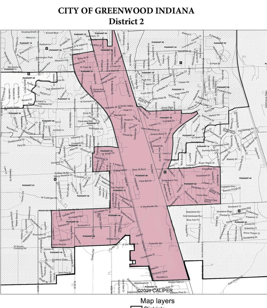
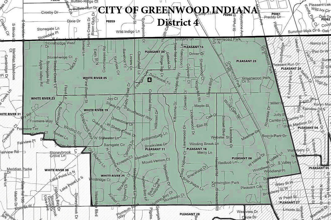
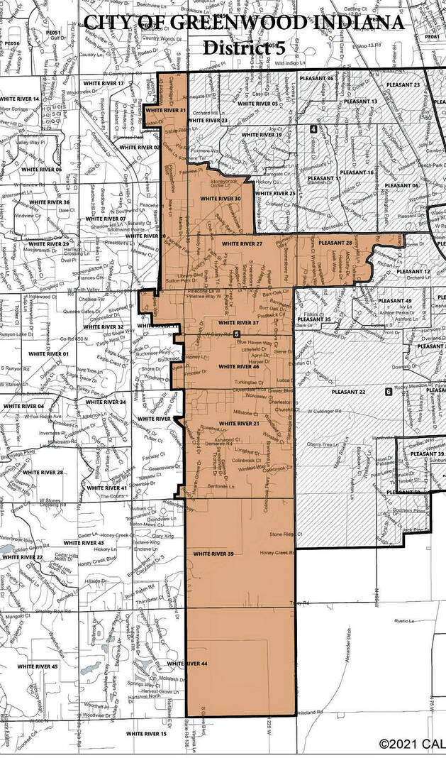
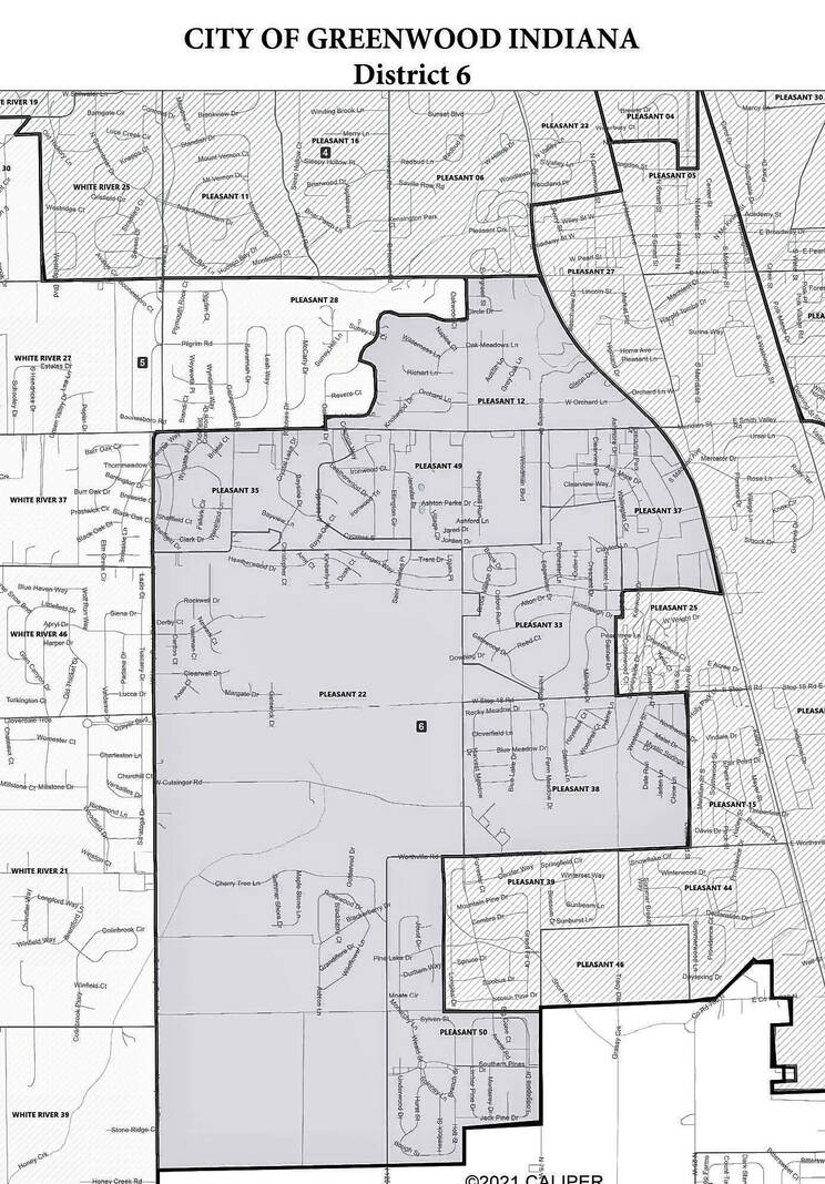
This map shows the proposed boundaries for the Greenwood Common Council single-member districts based on 2020 census numbers.
Maps provided by the city of Greenwood
New maps for the Greenwood Common Council’s six numbered districts will be introduced Monday.
The maps are being reworked ahead of next year’s municipal election to reflect changes in population from the 2020 census. The new districts feature several changes in response to the city’s growth in the last 10 years.
The city hired Indianapolis law firm Kroger Gardis Regas, LLP to help officials through the redistricting process for the council’s six single-member districts. The redistricting plan that will be discussed during a public hearing Monday is the result of the firm working with city council president Mike Campbell to establish boundaries that were compliant with state law and the constitution, officials said.
At the end of Monday night’s meeting, the city council is expected to adopt an ordinance preliminarily approving the plan. The council posted redistricting guidelines and gave residents the opportunity to submit their own maps, but no public proposal was submitted before the deadline last Wednesday, according to the City Clerk’s Office.
People who want to comment on the maps but can’t attend the meeting should send written comments to the city clerk by 12 p.m. Monday, prior to the public hearing.
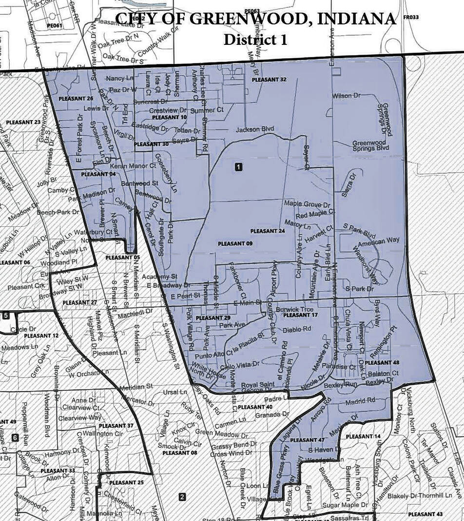
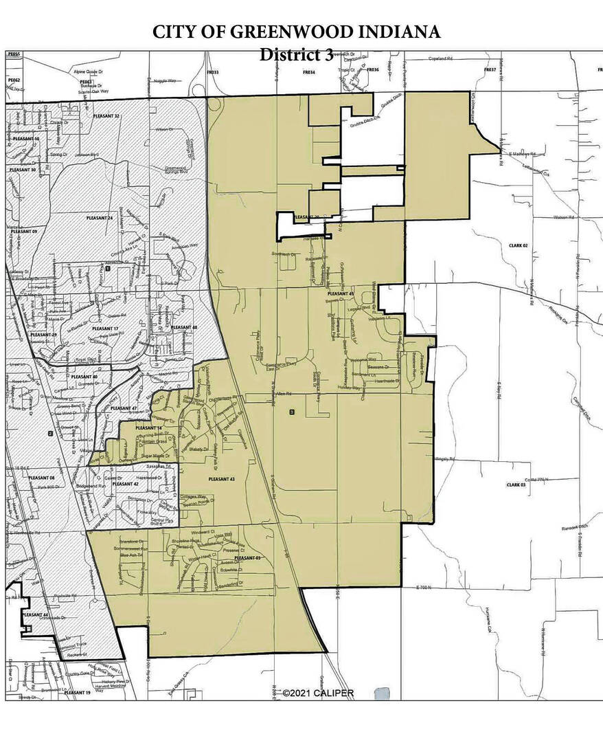
Greenwood’s population grew to 63,830 in 2020, an increase of 14,039 people from the 2010 census. The city did not grow evenly among all districts, so major changes were expected. For example, at the start of the redistricting process, District 1 had 8,548 people, while District 3 had 12,592 people, according to city documents.
Each of the numbered districts should have an ideal population size of 10,638, as determined by the city’s 2020 Census population. Under the proposed maps, the districts are nearly equal to this number, city documents show.
The guidelines adopted by the council for redistricting said there should be a standard deviation of 5% or lower among the districts. Case law from various redistricting challenges over the years has set a standard of 10% or lower. However, it is better for districts to be more equal if possible, Brian Bosma, an attorney from Kroger Gardis Regas, told the city council last month. Bosma is a former speaker of the Indiana House of Representatives who has had experience with redistricting at the state level.
The city’s districts were approaching a standard deviation of 50%, he said. Under the new maps proposed by the council, the total deviation is 5.15%, city documents show.
While the deviation is slightly above the 5% outlined in the adopted guidelines, the proposed ordinance that would approve the new maps would find that the plan does maintain precincts in a manner “that preserves precinct integrity, promotes election efficiency and minimizes voter confusion,” city documents say.
The maps do not show any precincts being split up, with the exception of precincts that are split by the city limit. In those cases, people who live within the precinct but in unincorporated Johnson County would not be eligible to vote in city elections.
Every council district would see changes under the new maps. Some would see bigger changes, like District 2, which would no longer stretch all the way to County Line Road, instead ending near Carney Drive. The district’s eastern border would move from the city limits southeast of Worthsville Road to the railroad tracks between U.S. 31 and South Emerson Avenue. The area lost would be added to District 3.
Other districts would see smaller changes. District 4’s eastern border will move from U.S. 31 and Howard Road to Madison Avenue. The southern border would continue to follow Main Street, before moving to Euclid Avenue near U.S. 31.
After Monday’s public hearing and introduction of the maps, one more reading of the maps will take place before their adoption, if all goes according to plan. The second reading is tentatively set for Oct. 3, at 7 p.m. at the Greenwood City Center.


