


This Nineveh home was severely damaged by an F3 tornado on July 30, 1992. The F3 was one of two tornadoes to hit Johnson County that day.
Daily Journal Archives
For the last 200 years, Johnson County residents have experienced all sorts of weather.
This Severe Weather Preparedness Week, and in honor of the county’s bicentennial, the Daily Journal is taking a look back at some notable severe weather events — tornadoes, floods and wind damage — in the county’s history and how they affected residents. Winter weather events, like blizzards and cold snaps weren’t included.
October 1954 F3 Tornado
An F3 tornado with winds from 158 to 206 mph killed two and injured four as it traveled across portions of central Johnson County and the city of Franklin on Oct. 11, 1954.
The twister touched down around 2:15 p.m. near South County Road 100 West, and from there traveled parallel to State Road 44 before entering Franklin. Once in Franklin, it traveled across what was mostly undeveloped farmland on the city’s westside. The F3 traveled from near Johnson Memorial Hospital into what is now several housing additions before crossing U.S. 31. The twister continued on a northeasterly path through the city before dissipating near what is now Commerce Parkway, according to the National Weather Service.
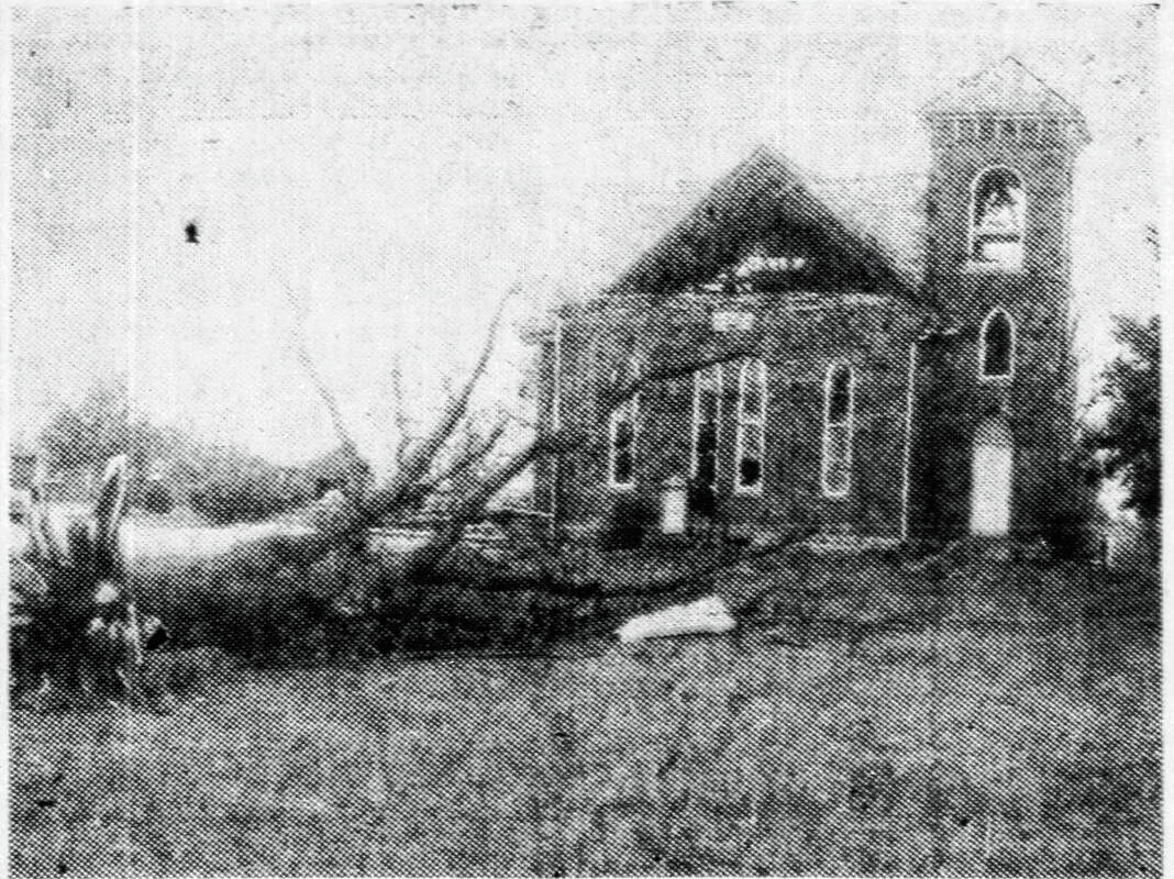
First Mount Pleasant Baptist Church along State Road 44 sustained heavy damage from the twister, later being declared a total loss and being fully rebuilt. In Franklin, heavy damage was reported on Highland Avenue, Lynhurst Drive and Circle Drive, according to reports in The Franklin Evening Star.
March 1986 F3 Tornado
In early March 1986, an F3 tornado injured three people in Johnson County and caused more than $2.5 million in property damage.
The tornado touched down around 1:45 p.m. on March 10, 1986 southeast of Paragon in Morgan County and moved northeast into Johnson County and through Bargersville, according to the NWS. From there, the tornado hit New Whiteland and Whiteland and continued into northern Shelby County before dissipating. A total of 22 people were injured by the tornado during its 35-mile track through three counties.
Northwest of Bargersville, the tornado clipped Mt. Auburn Church. About 150 children were at the church’s preschool when the storm hit, and all escaped serious injury when the storm ripped off the church’s roof. One girl did reportedly suffer from a broken finger, according to reports in the Daily Journal at the time.
Overall, an estimated $5 million in damage was caused in Johnson County by the storm, including the tornado. Eleven power transmission towers were knocked down in Clark and Needham townships by the storm, reports show.
July 1992 F0 and F3 Tornadoes
On July 30, 1992, Johnson County was hit by two tornadoes on the same day.
The first tornado, an F0 with winds from 40 to 72 mph, injured one person. The tornado touched down at 7 p.m. east of Trafalgar, and traveled northeast and across S. County Road 225 West before dissipating, according to the NWS.
Only 10 minutes later, a second tornado touched down in the county. This tornado, an F3 with winds from 158 to 206 mph, injured 25 people and caused $25 million in property damage, the NWS says. The F3 touched down northwest of Nineveh before making its way through the town. The F3 continued southeast before dissipating near Edinburgh.
Hundreds of trees were broken and uprooted, power lines were snapped and at least one rural home was destroyed by the twisters. About $250,000 in damage was reported at Camp Atterbury, and damage reports in Edinburgh included roofs of homes being torn off and the tops of trees being pulled away, according to reports in the Daily Journal.
In Nineveh, where a rural home was destroyed, residents reported half of a barn being torn down and all sides of their home being damaged. The storm had come so suddenly, many had little time to seek shelter, reports show.
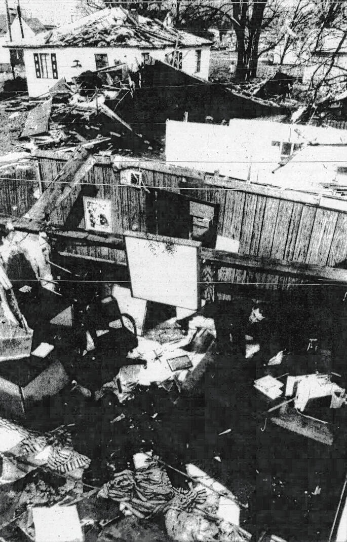
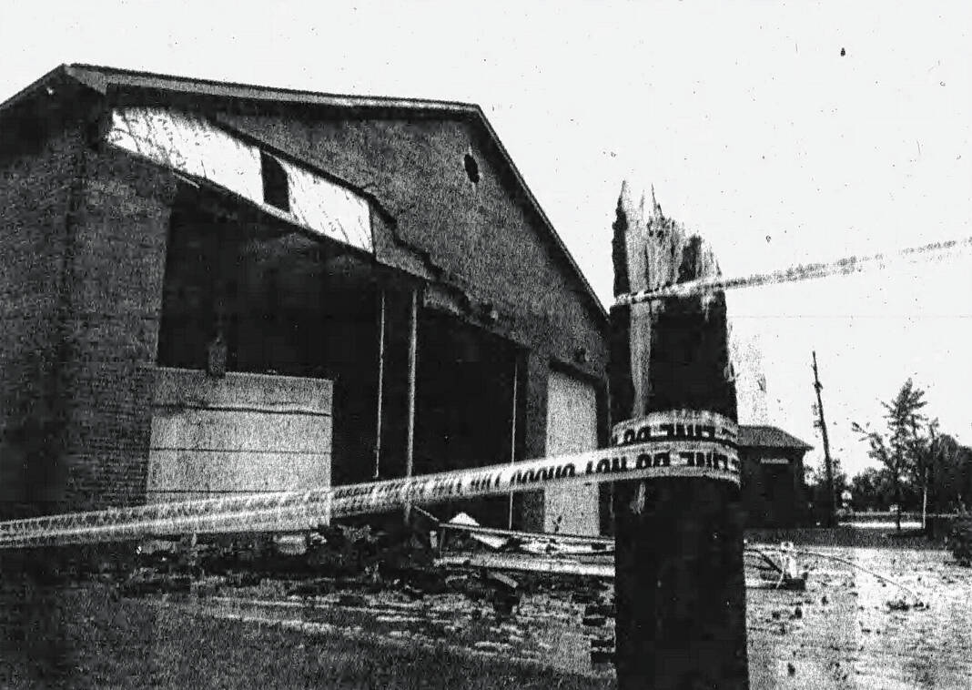
September 2002 F3 Tornado
An F3 tornado with winds from 158 to 206 mph caused about $25 million in property damage when it hit northern Johnson County in September 2002.
The tornado touched down around 1:35 p.m. on Sept. 20, 2002, and is one of the longest-track tornadoes in Central Indiana history. It traveled from Ellettsville in Monroe County through Morgan, Johnson, Marion, Hancock, Hamilton, Madison and Delaware counties before dissipating in central Blackford County. No one was injured by the twister in Johnson County, but 127 injuries were reported during its 112-mile trek through nine counties, according to the NWS.
In White River Township, a fire station was destroyed. Along State Road 135, metal was ripped off brand-new businesses and dropped in nearby parking lots. Other places had homes leveled, according to reports in the Daily Journal.
The bulk of the damage in Johnson County took place in residential areas, with many residents reporting roof damage, air conditioners pulled out and broken windows. Some homes in the Brentwood subdivision reported more severe damage to their homes, reports say.
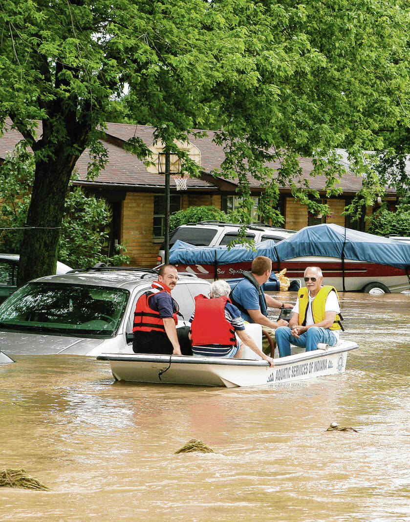
June 2008 Flood
In early June 2008, a 100-year flood caused millions of dollars of damage and forever changed Johnson County.
Residents woke up on June 7, 2008, to water rising in the streets, and within hours, it was inside their homes. Cars were washed away, homes destroyed, police cars were swept away and government records and officers were left in ruin. Residents left their homes and some were never able to return, according to reports in the Daily Journal.
The devastation hit the entire county, from Edinburgh — where residents were recovering from an EF2 tornado that hit only days earlier — to Franklin — where downtown was impassable — to Bluff Acres in the Center Grove area where floodwaters filled basements to the brim, reports show.
In the aftermath, millions of dollars were spent on recovery and improvements. Residents moved, buildings were demolished. A heavily-damaged Franklin neighborhood was turned into an urban forest. A former county government building is now part of Youngs Creek Park, which was designed with lots of green space to sop up flood waters in the event of another major flood.
Youngs Creek ultimately crested at 15.67 feet near Amity on June 7, 2008 — the highest crest ever recorded at the river gauge there, according to the NWS.


