


8:15 pm UPDATE
The possible tornado hit the Center Grove area around 4:15 p.m. Sunday, damaging homes in Kensington Grove, Golden Grove and Clary Crossing neighborhoods, as well as homes just south of Center Grove High School, Bargersville Fire Chief Eric Funkhouser said in a news conference at the Bargersville Fire Station.
There weren’t any major injuries reported from the storm, although about 75 homes have moderate to severe damage. People are advised to stay out of affected neighborhoods until utility workers finish securing downed power lines, as some of those lines might still be active, he said.
While road closures are constantly changing, Travis Road will remain closed, except for local traffic, between Morgantown Road and Mullinix Road for the time being, Funkhouser said.
The Johnson County REMC has worked quickly to restore power. Initially, there were almost 12,000 people without power, but that number had dropped to about 3,700 people by shortly after 8 p.m., Bargersville Town Manager Dan Cartwright said.
Power to most remaining residents should be restored within the next 24 to 48 hours, he said.
While volunteers should wait until utility workers finish cleaning up power lines to help out, they can follow Bargersville Fire Department social media pages for updates on when and how to help, Funkhouser said.
It is important for people who don’t live in affected neighborhoods to steer clear for now, Bargersville Police Chief Todd Bertram said.
“The biggest problem we’re facing is traffic in the area,” he said. “Please stay out of the area.”
8:02 P.M. UPDATE
Per Bargersville Utilities on social media: “Power has been restored to residents south of Whiteland Rd. Residents north of Whiteland Rd should be prepared to be without power for the next 48+ hours.”
Johnson Memorial Health’s Stones Crossing clinic was damaged by the storm and will be closed Monday, the health system said on social media. Patients with appointments scheduled for Monday can call the Franklin Family Medicine office at 317-736-6133 to reschedule.
7:20 p.m. UPDATE
The threat of severe weather is over for Johnson County tonight, the National Weather Service says.
The storm system that brought severe weather — including the possible tornado — to the county has moved off to the south and east of the area. There may be some rumbles of thunder from scattered showers, but there will not be severe weather like what was just experienced, said Mike Ryan, a meteorologist with the Indianapolis Forecast Office of the NWS.
The storm that entered Johnson County was part of a line of storms quickly developed and became severe west of Indianapolis. It entered Johnson County between 4 to 4:30 p.m. with hail and strong winds, Ryan said.
Eventually, meteorologists issued a tornado warning for the storm after radar imagery indicated it was rotating — and possibly had a tornado. The NWS began to receive reports of damage following the warning, he said.
Most of the damage reports have been in the vicinity of Stones Crossing Road in the Center Grove area. Reports have also come in as the storm traveled east across the south side of Greenwood to the Whiteland area, Ryan said.
The NWS is still collecting information about the storm, and has seen some of the videos and photos taken of the possible tornado, he said.
“As we collect that information, and coordinate with officials, we will send one or two teams to Johnson County in the morning to investigate further,” Ryan said.
More detailed information is expected to come out Monday once the teams have had a chance to survey the damaged areas. They are expected to be out by 9 a.m. to work with local law enforcement and emergency officials to investigate and make determinations about the damage and its severity, he said.
This possible tornado is likely causing a a bit of deja vu for many county residents, as it is the the third tornado to affect Johnson County in as many months.
On March 31, two twisters touched down in the county as part of a wide-ranging outbreak that spawned 145 tornadoes across the midwestern, southern and eastern United States. In Indiana alone, severe storms caused a total of 23 tornadoes across the state from March 31 to April 1, damaging more than 1,000 structures, injuring 34 and killing five.
Locally, two tornadoes touched down on March 31: an EF-0 near Bargersville that downed power lines and damaged buildings and an EF-3 that caused significant damage in Whiteland, damaging 179 homes — including destroying 16.
Large areas of Whiteland are still recovering from the EF-3 tornado.
UPDATE 6:50 P.M.
No injured persons were found in the first pass-through, local public safety officials are moving into secondary searches to confirm, said Mike Pruitt, Bargersville deputy fire chief.
The area with the most damage is in the area around State Road 135 north of Smokey Row Road and south of Stones Crossing, which is a densely populated area, Pruitt said.
The damage is being assessed still but there are a number of homes that collapsed or sustained some level of damage, he said.
People are asked to stay out of the area as power lines are down and law enforcement is attempting to secure the area, he said.
Johnson County officials are putting in place a curfew from 9 p.m. to 6 a.m. in the damaged area, Pruitt said.
Johnson County EMA and the American Red Cross are coordinating to set up a shelter at Greenwood Middle School, 1584 Averitt Road, Greenwood. It is expected to be open sometime after 7 p.m., said Stephanie Sichting, the county EMA director.
The EMA has had several requests for shelter as several homes collapsed. Red Cross will have the shelter open as soon as possible, she said.
The following roads are among those closed because of storm damage:
- Travis Road is closed between Mullinix Road to Morgantown Road;
- Morgantown Road from Mullinix Road to Whiteland Road;
- Stones Crossing Road from State Road 135 to Saddle Club Road;
- Saddle Club Road from Stones Crossing Road to Smokey Row Road.
Several neighborhoods along those roads are also closed off to the public as well due to storm damage, officials say.
UPDATE 5:45 P.M.
Parts of northern Johnson County have been hit by a tornado and the damage area covers a very large area. Several neighborhoods and homes have been damaged or destroyed, county officials are saying.
“We are asking that if you do not live in the area please stay out of the area because you are hindering the work of Emergency workers,” Sheriff Duane Burgess said in a press release.
Law enforcement has closed several roads in the area.
UPDATE 5:33 P.M.
The threat for more severe weather continues for Johnson County.
A tornado watch remains in effect until 8 p.m. ET. A few tornadoes are possible, according to the National Weather Service.
Severe thunderstorms with a history of producing damage are moving east and are starting to exit the agency’s Indianapolis forecast area, according to a 5:28 p.m. tweet from the agency.
Multiple reports of damage continue to come in from the White River Township and Bargersville area.
Johnson County REMC is mobilizing to restore power.
“We are evaluating the situation and will begin working toward safely restoring power as soon as possible,” the utility said on their Facebook page.
UPDATE 5:21 P.M.
Power is out in the tornado-damaged area and maybe be out for sometime.
“At this time, it looks like power could be out for an extended period of time. We will know more after crews are able to assess the damage. We appreciate your patience while we work to restore power as quickly as possible,” the town of Bargersville said on Facebook.
At least 1,000 Duke Energy customers in White River Township and over 450 in Greenwood are out of power, along with about 16 in New Whiteland, according to the utility’s outage map. Duke Energy is estimating where customers could be restored by 10:30 p.m. Sunday.
ORIGINAL STORY
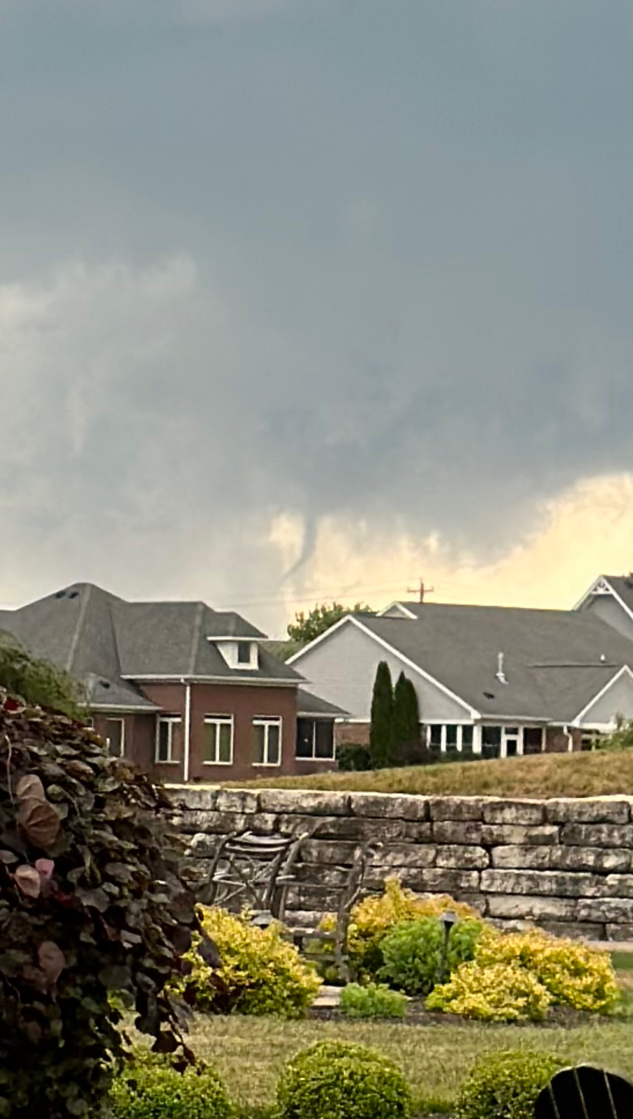
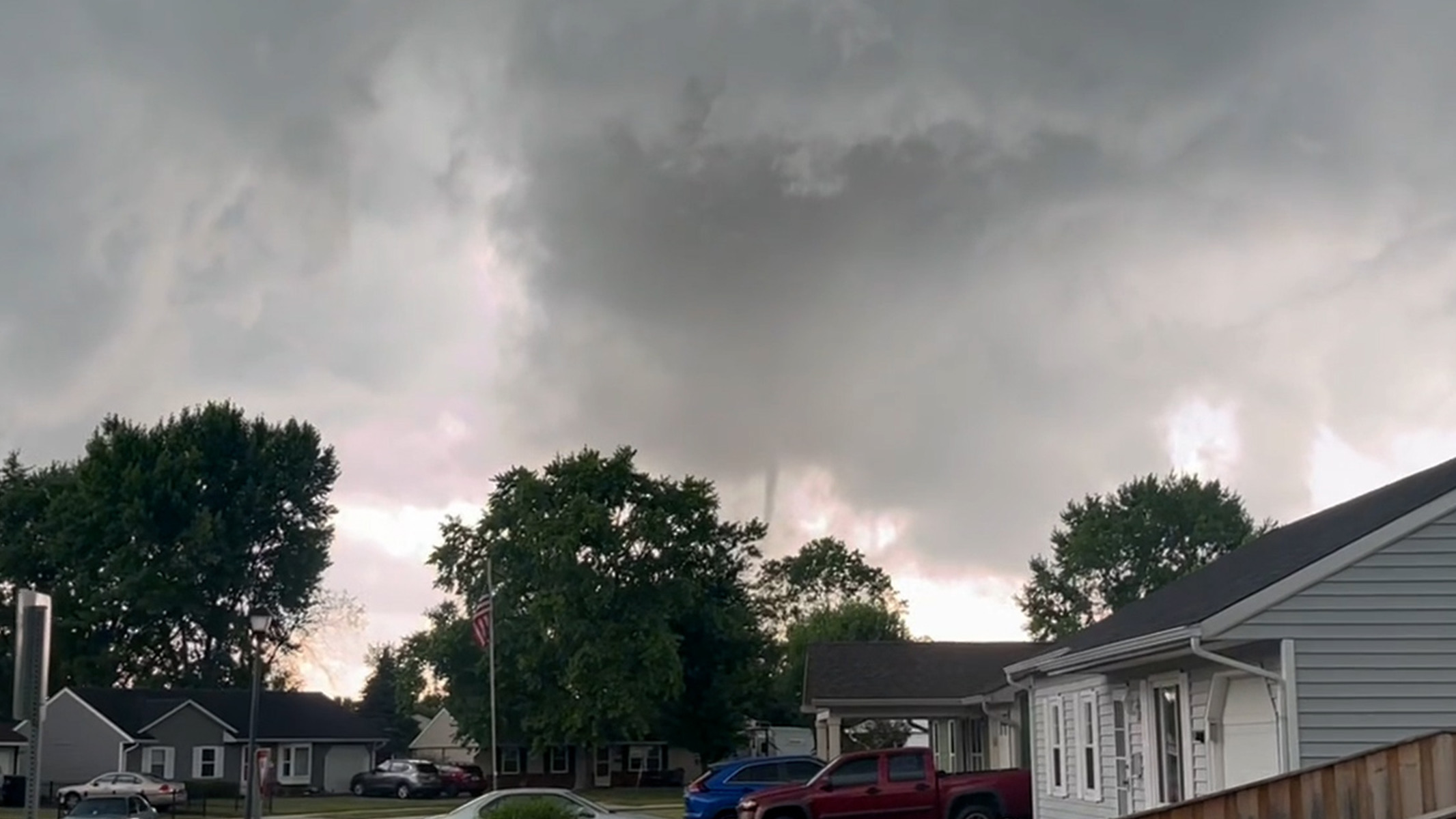
A possible tornado touched down in Johnson County again Sunday afternoon. This time in White River Township, cutting a path across New Whiteland and Clark Township.
Multiple photos of a funnel cloud sighted in the New Whiteland have been posted online. An unclear number of structures have been damaged and powerlines are down, local officials say.
This story will be updated as more information becomes available.
Send comments and storm damage photos to [email protected].


