

8:30 p.m. UPDATE
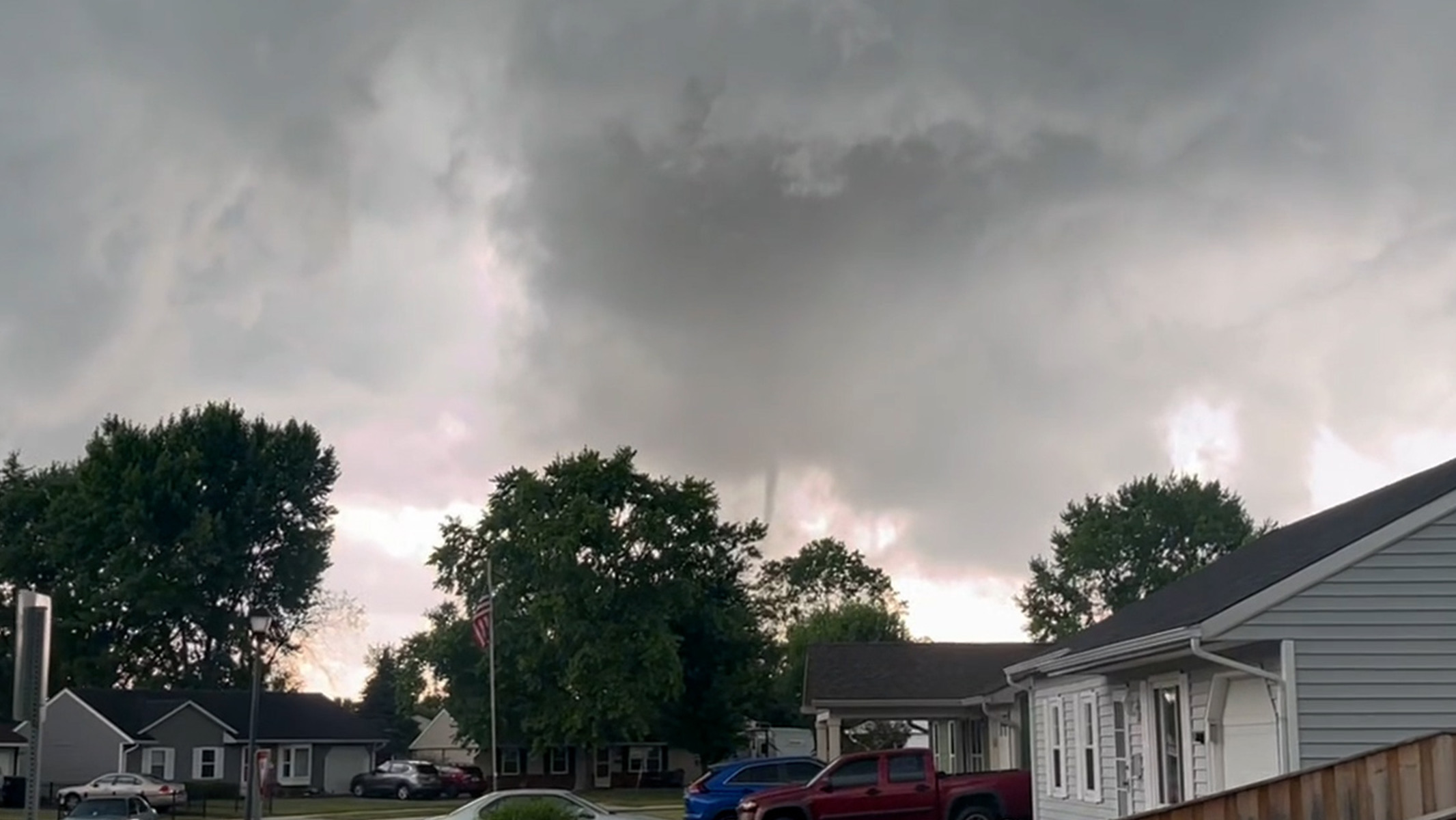
The tornado that carved a path of destruction across northern Johnson County has now been upgraded to an EF-2, with a path length of 5.4 miles, the National Weather Service says.
Earlier on Monday, the twister was preliminarily rated as an EF-1. However, in a public information statement issued at 7:48 p.m. Monday evening, the twister was upgraded to an preliminary EF-2 with peak winds of 115 mph.
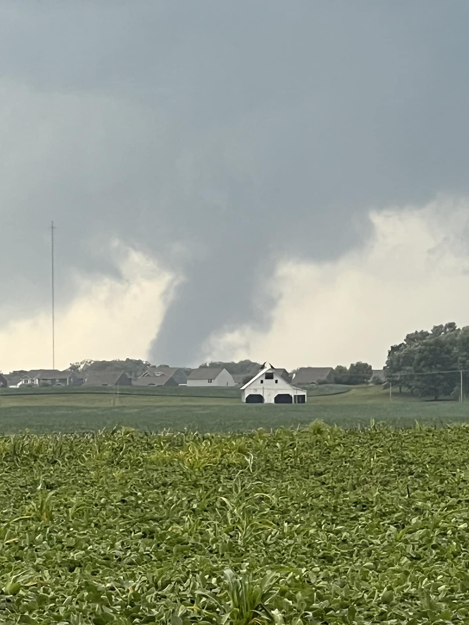
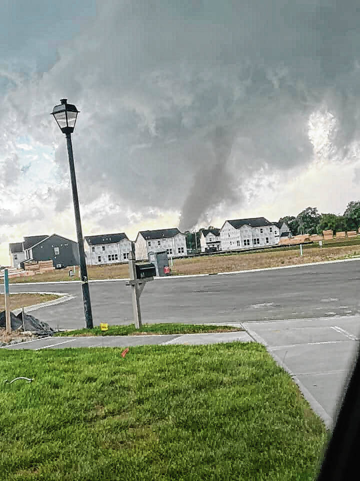
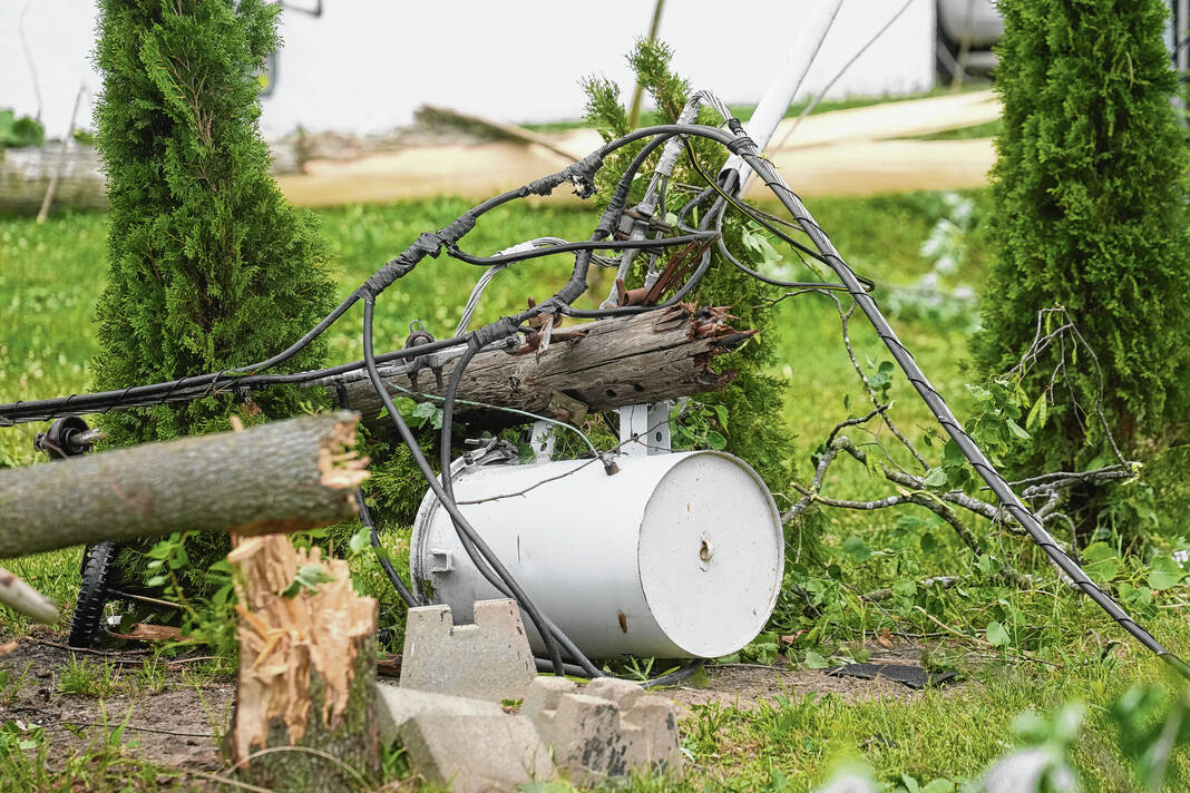
The twister touched down at 4:13 p.m. just west of the intersection of Travis and Mullinix roads before moving east, intensifying quickly and causing damage to homes near the intersection. Damage included bricks blown off a large house, roof damage, snapped trees and a few snapped power poles, according to a public information statement from the NWS’ Indianapolis office.
In this area, the tornado was estimated to have winds of up to 110 mph — high-end EF-1 damage. However, meteorologists observed some low-end EF-2 damage in the area as well, with maximum winds of 115 mph estimated.
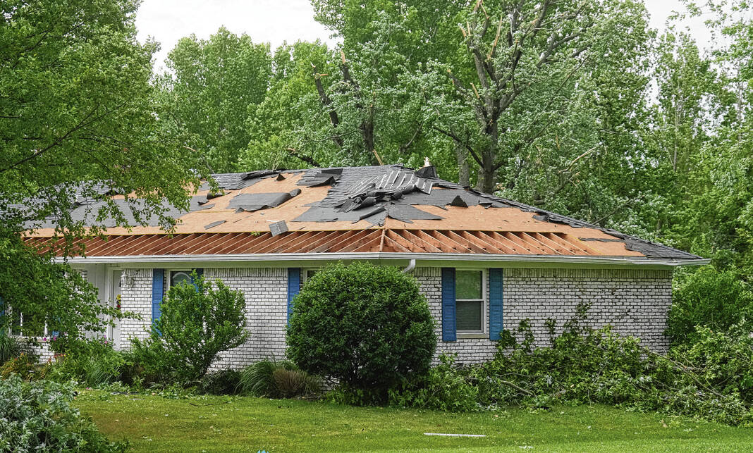
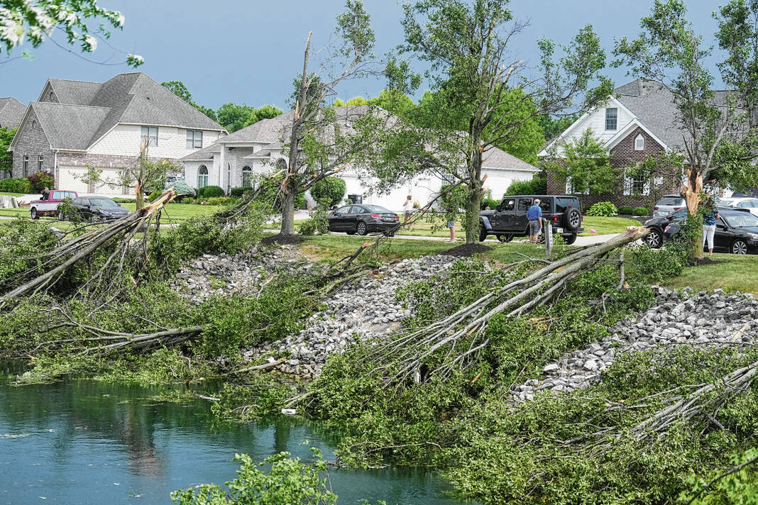
From here, the twister moved east through parts of the Kensington Grove subdivision with substantial roof damage to some homes and some trees downed and snapped. Winds of 95 to 110 mph were estimated here, according to the NWS.
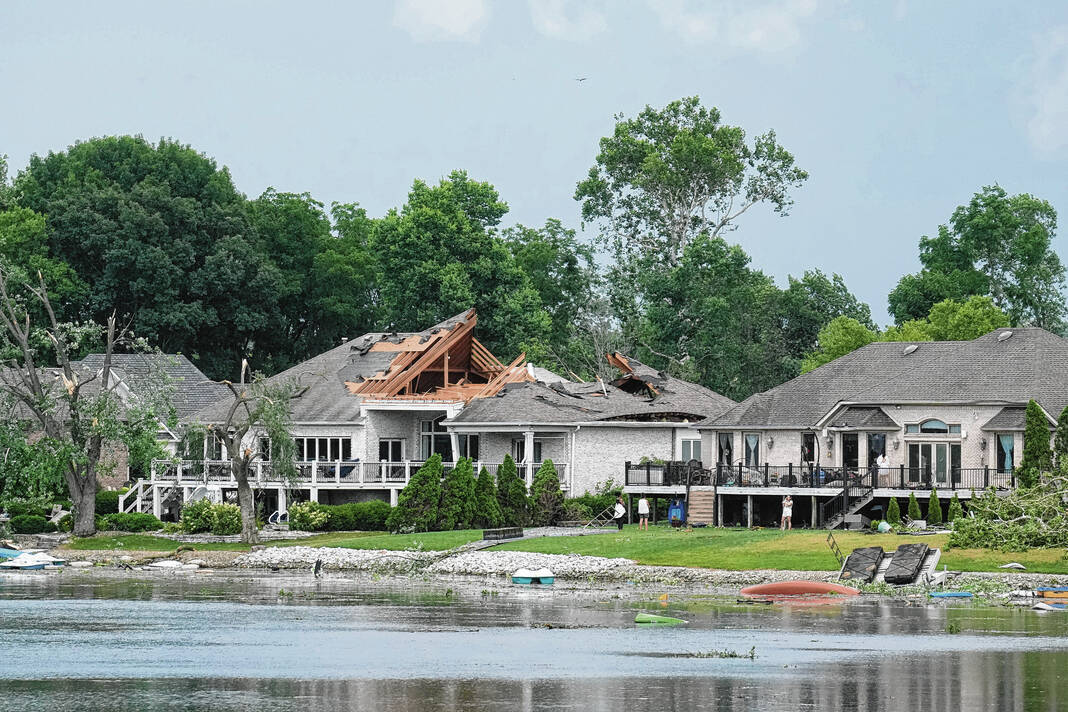
The twister then entered the Waters Edge neighborhood, traveling over the pond in the area with winds of about 90 to 100 mph, the NWS says.
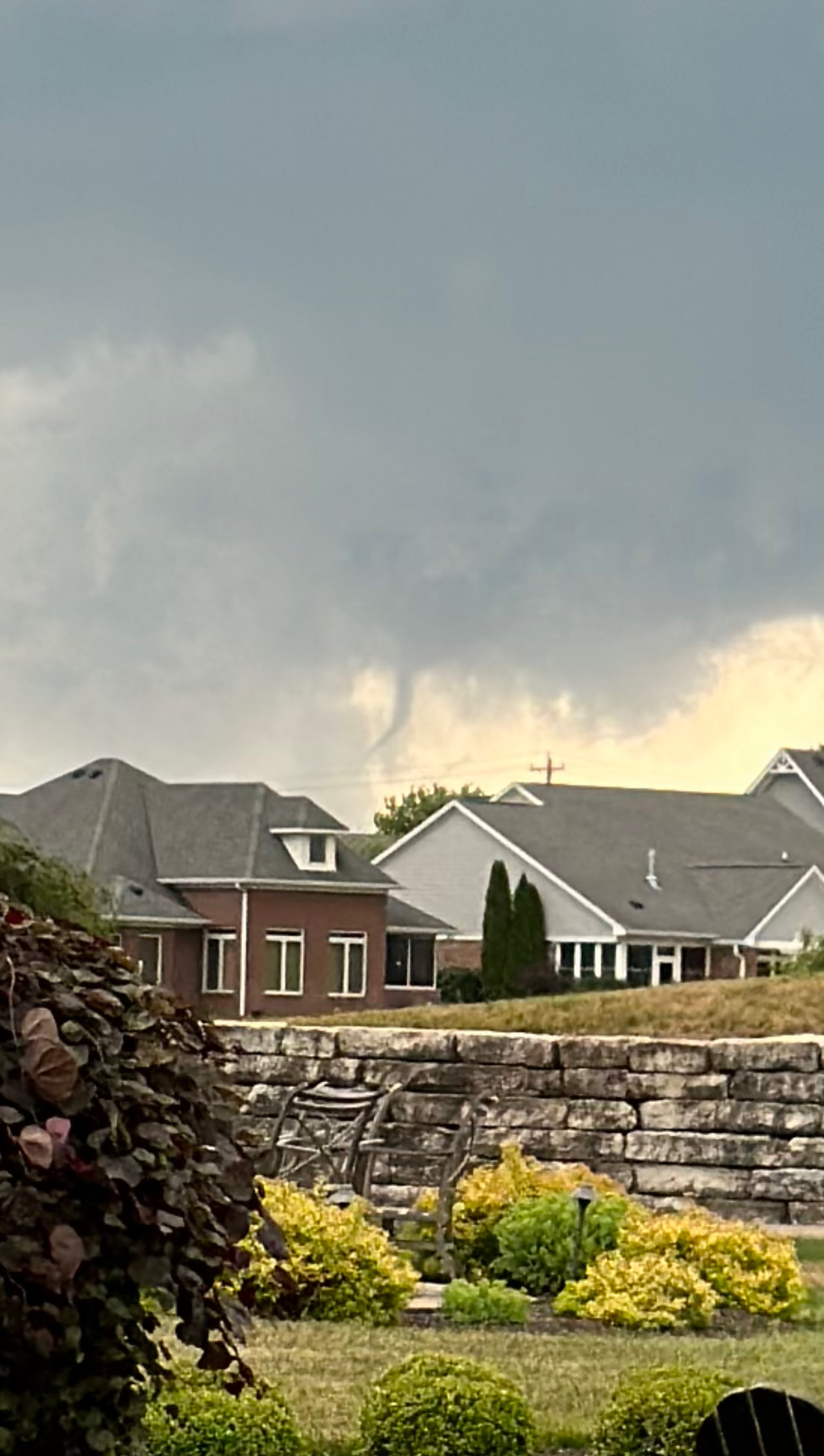
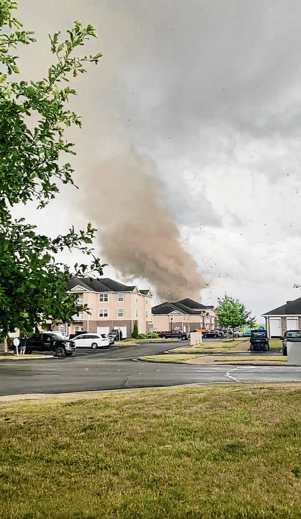
It continued past the Old Marsh on State Road 135, and just east of there it hit part of an apartment complex under construction. One of the building’s in the complex had its roof torn off the length of the building, along with many broken windows and “even a few pieces of debris impaled into the ground,” the NWS says.
Winds of about 115 mph were estimated here, meteorologists say.
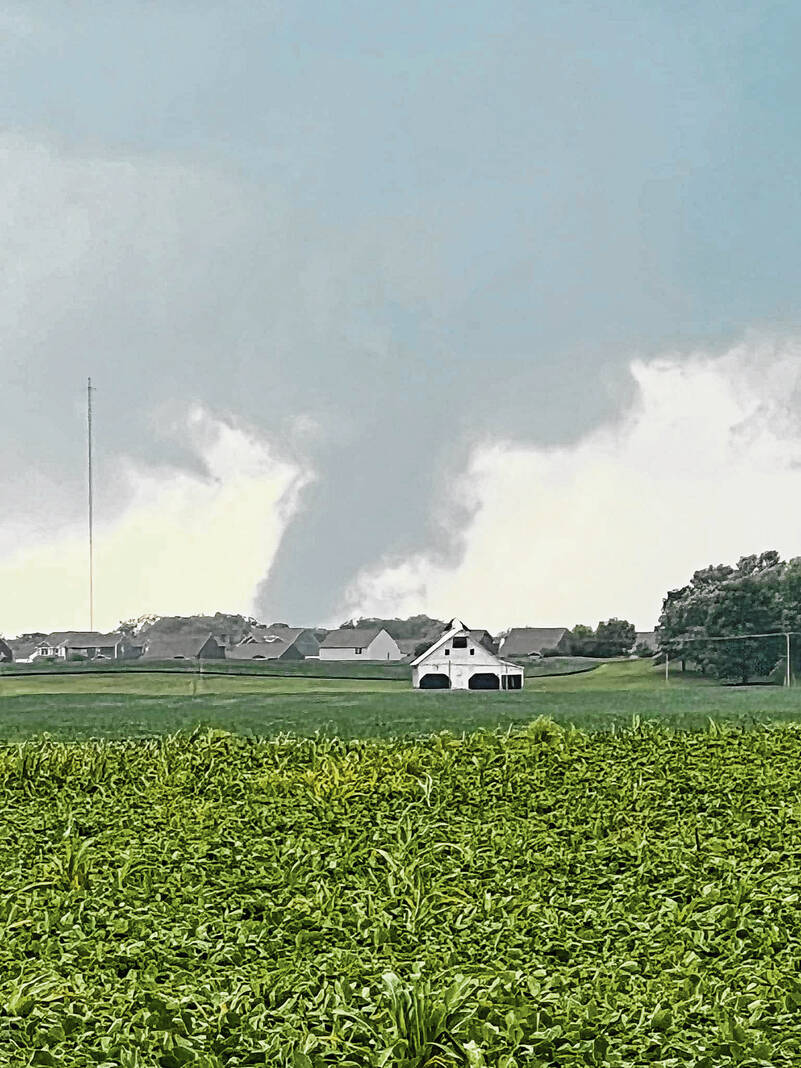
The tornado then turned southeast, passing over an open field where a narrow debris swath was left behind. Meteorologists say the tornado may have skipped up and down a bit in this area.
After this, the twister came down and snapped and uprooted numerous trees along West County Road 600 North — just south of the Restoration Church. Meteorologists found more high-end EF1 damage here, with winds estimated at 100 to 110 mph, the NWS says.
The tornado then lifted roughly a quarter or third of a mile southeast of this location — west of New Whiteland — at 4:23 p.m. Meteorologists say there was no real further evidence of a tornado from that point on.
At its maximum width, the twister was anywhere from 200 to 400 yards wide. It was on the ground for 10 minutes, the NWS says.
If new information comes in, updates may be made to the twister’s information and rating, NWS Indianapolis said in a tweet.
The agency also thanked Johnson County EMA Director Stephanie Sichtning for taking storm surveyors to all of the damaged areas
7:15 p.m. UPDATE
Residents of Johnson and Monroe counties are asked to contact Indiana 211 to report damage from Sunday’s tornado.
To help establish a comprehensive assessment of damages, residents can call 211 or visit the Indiana 211 website. Collecting assessments via this process will help IDHS determine damage estimates and develop the next course of action in the disaster recovery process.
Currently, only residents in Johnson and Monroe counties should utilize Indiana 211 for damage reports. Other counties should reach out to their local emergency manager.
Agricultural damage should be reported to the Purdue Extension.
5:35 p.m. UPDATE
The Johnson County Board of Commissioners officially issued an emergency disaster declaration for Johnson County. The declaration includes a new curfew for affected areas in unincorporated White River Township from 9 p.m. to 6 a.m..
The curfew starts this evening and will be in effect until July 3.
It applies to the following area:
- Stones Crossing Road from Mullinix Road to State Road 135;
- Mullinix Road from Stones Crossing Road to Smokey Row Road;
- Morgantown Road from Smokey Row Road to Whiteland Road;
- Whiteland Road from Morgantown Road to Saddle Club Road;
- Saddle Club Road from Whiteland Road to Smokey Row Road;
- Smokey Row Road from Mullinix Road to State Road 135.
This includes the Kensington Grove, Golden Grove, Stones Bay and Waters Edge subdivisions.
During the curfew, no one can travel on public streets or in public places within the affected unincorporated area, unless exempt, the emergency declaration says. Those exempt include law enforcement, fire and medical personnel, people traveling to and from work and homeless people.
Fireworks are also prohibited within the affected areas during the curfew.
5 p.m. UPDATE
The tornado that touched down in Johnson County Sunday has preliminarily been rated an EF-1, with winds between 100 to 110 mph, according to the National Weather Service.
An exact damage path has not yet been made available, and a final rating will be released in the coming days, an official said.
4:50 p.m. UPDATE
The Johnson County Commissioners are working to issue an emergency declaration for the affected areas in White River Township.
Part of that emergency declaration includes a curfew from 9 p.m. to 6 a.m. for the next seven days. The county’s legal team is working on finalizing the declaration.
During an emergency commissioners meeting Monday afternoon, Stephanie Sichting, Johnson County Emergency Management director said the path of damage started at Travis and Mullinix roads and went through the Kensington Grove, Golden Grove, Stones Bay, Waters Edge and Clary Crossing subdivisions.
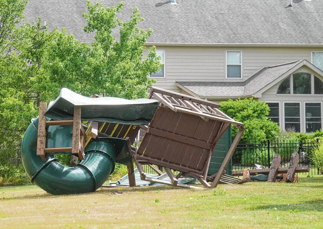
Houses on Travis Road and Kensington Grove saw the most damage. Kensington Grove had many roofs missing, and roof pieces were all over the place Monday, she said.
“There’s a lot of roof missing and it’s everywhere in that edition. We have some in cul-de-sacs. I mean, there’s roofs in there that people don’t even know where they come from,” Sichting said.
She and the commissioners discussed cleanup efforts, and how the county government should assist. The commissioners decided to allow the highway department to hire contractors to pick up debris and trees residents place on the curbs. Debris has to be placed on the curb, and will not be picked up on private property, Sichting said.
The commissioners also had discussion on how to pay for this help and what fund it could come out of, which was still up in the air at the end of the meeting. They weren’t sure if the county could get federal disaster relief reimbursements.
They were concerned that this area likely may not qualify for relief from the Federal Emergency Management Agency, or FEMA, like Whiteland did after the March 31 tornado. Sichting was not sure the $700,000 threshold could be met in expenses and homeowners’ insurance deductibles.
There are also likely less people uninsured in these neighborhoods, compared to Whiteland, which is what a lot of FEMA aid is used for, they said.
“There were more uninsured and higher deductibles (in Whiteland), where these areas that have been hit, probably won’t have that,” Commissioner Brian Baird said. “I don’t want to say ‘unfortunately,’ but that’s a fact.”
Sichting also noted a lot of damaged houses already had contractors out working on roofs Monday. Some homeowners may not be waiting on insurance or assistance.
“How do you get insurance claims that fast? I’m guessing a lot of them are just paying for it,” Sichting said.
The commissioners said they felt they needed to step in to help in some way, whether funds get reimbursed by disaster relief or not. There are potentially options to get assistance at the state level, they said on Monday.
“We have to do everything we can to help them, regardless of what FEMA does because, again, I don’t think FEMA is going to kick in anyway,” Baird said.
3:30 p.m. UPDATE
Duke Energy is now reporting 34 customers are without power, with the outage still ongoing for an area near the Water’s Edge neighborhood and along Morgantown Road.
Johnson County REMC is reporting 49 outages, 36 of which are within the White River South District. This accounts for 2,765 customers, according to JCREMC’s outage map.
Both Duke Energy and JCREMC expected remaining power outages to be restored Monday evening, officials said.
2:30 p.m. UPDATE
At the corner of State Road 135 and Stones Crossing Road, rubble lines the edges of the street with power lines and stop signs leaning every which way.
The Greenwood location of JCBank had some windows busted out yesterday evening, after opening recently. Restoration and lawn care company Chris’ Lawn Care was out picking up glass and helping to restore the bank’s landscaping. One landscaper shared that just last week, they laid brand new sod, only for it to be ripped up by the storm.
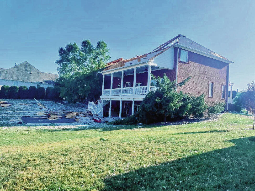
Just five minutes east in the Kensington Grove neighborhood, many homeowners lost siding and portions of their roof. Terry Weddle, a long-time resident, was in the basement with his wife when yesterday’s tornado ripped through their backyard.
“We were listening to Channel 6 and they talked about Noblesville and Bloomington but they didn’t say a word about here. I looked out and saw it right on the patio,” Weddle said, pointing to where his patio set once was.
Weddle’s family was on his property helping clean up, with his grandkids leading the raking and garbage collection mission.
“They’re good people. Wouldn’t be able to do it without them,” he said.
Randell and Becky Lee live just a few hundred feet away from Weddle, but they lost much more.
While the tornado managed to spare the Lees’ personal photographs and belongings inside their house, it destroyed the couple’s garage, with rubble falling on four of their vehicles.
Randell was inside the home when the damage occurred. He said even though he was so close to the tornado, it wasn’t quite loud enough to make him think it had done that level of damage.
“I never expected it,” he said, shaking his head at the remains.
His wife, Becky, wasn’t home when the tornado came through, but she said it was heartbreaking to come home and see the damage.
“It’s a tragedy. You know, we’ve lived here for 48 years,” Becky said. “It’s a blessing it didn’t get to the house inside and that my husband is okay.”
The Lees had their family over for moral support and help on Monday. A restoration company was working today to stabilize the home so an insurance investor could come through and give further help to the couple.
1:55 p.m. UPDATE
The National Weather Service has officially confirmed a tornado touched down in Johnson County Sunday afternoon.
Three tornadoes touched down in Indiana on Sunday: one in Johnson County, one in Martin County south of Shoals and one in southwestern Monroe County, according to a tweet from the agency’s Indianapolis office.
Additional details are expected to come out later on Monday, the tweet says.
12:30 UPDATE
Johnson County Commissioners Kevin Walls and Brian Baird were out helping and assessing the damage Sunday evening after the tornado swept through parts of unincorporated White River Township.
Monday morning at the regular Board of Commissioners meeting, the three commissioners thanked first responders and the county highway department for their quick response on Sunday.
“The first responders were there, I was watching them go door to door, address to address, double checking,” Walls said. “It was amazing to watch that take place and how it took place and you were very efficient in what you did. So, thanks to all the departments and everybody that was involved.”
By the time it was dark outside Sunday, first responders had all the affected subdivisions in the area cleared and conducted secondary searches, said Mike Hoffman, community liaison for the White River Township Fire Department. Hoffman attended the meeting on Monday to provide an update to the commissioners and also thank them for their help.
“The way that all the fire departments, and the police departments handled it and everybody worked together is only because of the funding you guys have provided over the last few years,” Hoffman said.
Baird said he remains amazed by the community of Johnson County coming together to handle a disaster. It was only three months ago when the county was last in this situation.
“Johnson County does well, and that’s not anything to us, it’s to the people of Johnson County and all that they do,” Baird said. “… we didn’t have any deaths or anything. But just the devastation and the people wandering around with the shock of losing what they have. You go around and you see that and you just don’t know what you can do to help. But we have the people in place that do know what to do to help them.”
12:12 p.m. UPDATE
Indiana Lt. Gov. Suzanne Crouch said her heart and prayers go out to the Indiana communities affected by yesterday’s tornadoes, especially to the family of the person who died in Martin County.
She also discussed the damage in Johnson County.
“Just three months after Whiteland was heavily damaged, residents of Johnson County have been dealt another direct hit by a tornado,” Crouch said in a tweet Monday. “As we did in April, the Indiana Housing and Community Development Authority will be ready to assist if needed.”
11:20 a.m. UPDATE
As of 9 a.m. Monday, Johnson County REMC workers had successfully restored power to Bargersville’s 3,566 utility customers, Bargersville spokesperson Carissa Comstock said, although she was unsure of how many customers were initially left without power after the Sunday storm.
Town officials aren’t conducting any organized volunteer efforts, as the town’s street department was able to help with cleanup efforts and check on the welfare of affected residents, she said.
People can follow the town of Bargersville social media updates on Facebook, Twitter and Instagram to check for any updates on any chances to help out if those opportunities arise, she said.
Duke Energy’s outage map shows 119 customers are still without power at this time. The outage is still ongoing for the Water’s Edge neighborhood and a business at State Road 135 and Stones Crossing.
11:15 a.m. UPDATE
The Red Cross Shelter at Greenwood Middle School has not received any persons in need of shelter, and will be transitioning into a reception center later today, the Bargersville Fire Department said Monday morning.
Residents can obtain water and food if needed at this location, the post says.
The curfew for the storm-damaged area has also been lifted, the fire department said.
11:00 a.m. UPDATE
Meteorologists from the National Weather Service in Indianapolis are conducting damage surveys in Indiana today.
Expected locations to be surveyed include the Greenwood-Whiteland areas in Johnson County. Officials will also be surveying the Martin County area and southwest Monroe County, according to the NWS.
The surveys come following Sunday’s severe weather and possible tornadoes. Locally, damage was reported in White River Township, Bargersville and Greenwood.
Elsewhere, a tornado struck a home in Martin County, killing one occupant and injuring another, while two people died in Arkansas after a tree fell onto a house there, the Associated Press reported.
No deaths or injuries have been reported from the storm in Johnson County. At least 75 homes suffered moderate to severe damage in a 3-mile area as the tornado made its way through the area.
Preliminarily, the National Weather Service received three tornado reports in Johnson County, though it is unclear if they are for the same or separate tornadoes as of now.
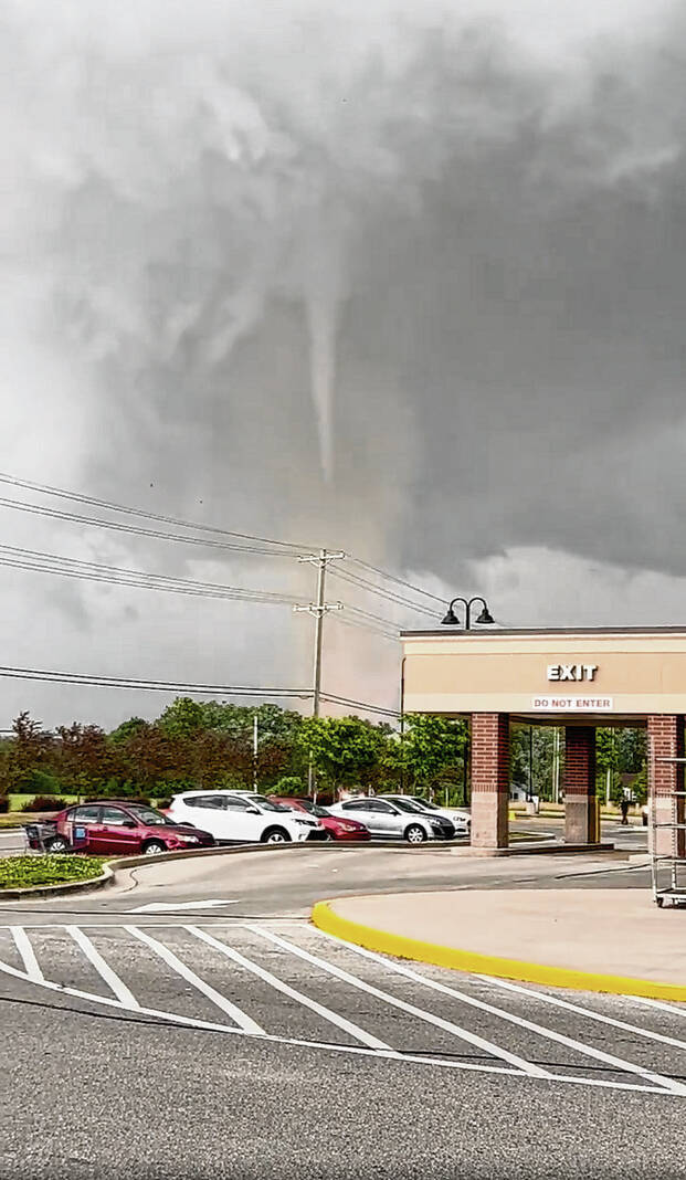
The first report was at 4:10 p.m., with the NWS saying they received multiple videos on social media of a tornado on the ground at the State Road 144 interchange at Interstate 69. Ten minutes later, a second preliminary report was made after multiple videos were sent in of a tornado on the ground near Stones Crossing Road and State Road 135.
The third preliminary report came in at 4:33 p.m., following multiple pictures from the public of a possible tornado in the area of U.S. 31 and Worthsville Road.
The NWS also received three separate reports of thunderstorm wind damage along Travis Road and in the Kensington Grove and Waters Edge neighborhoods, though the agency says the damage was possibly caused by a tornado. Damage to structures and roofs was reported, along with downed trees.
Indiana Gov. Eric Holcomb said the Indiana Department of Homeland Security will have staff on the ground assessing the damage to help local jurisdictions determine their rebuilding and recovery needs.
“Our thoughts and hearts go out to those impacted by yesterday’s tornadoes,” Holcomb said in a 9:44 a.m. tweet.
–Live updates from Noah Crenshaw, Andy Bell-Baltaci, Emily Ketterer, Leeann Doerflein and Ashlyn Myers


