

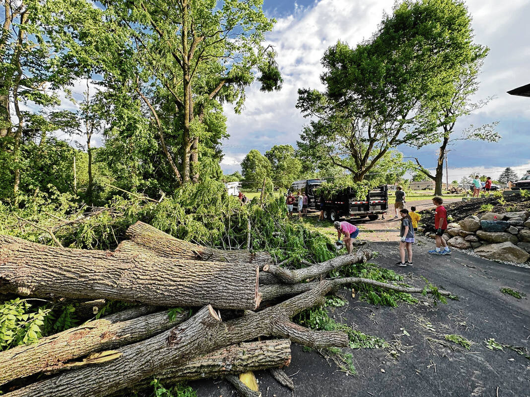
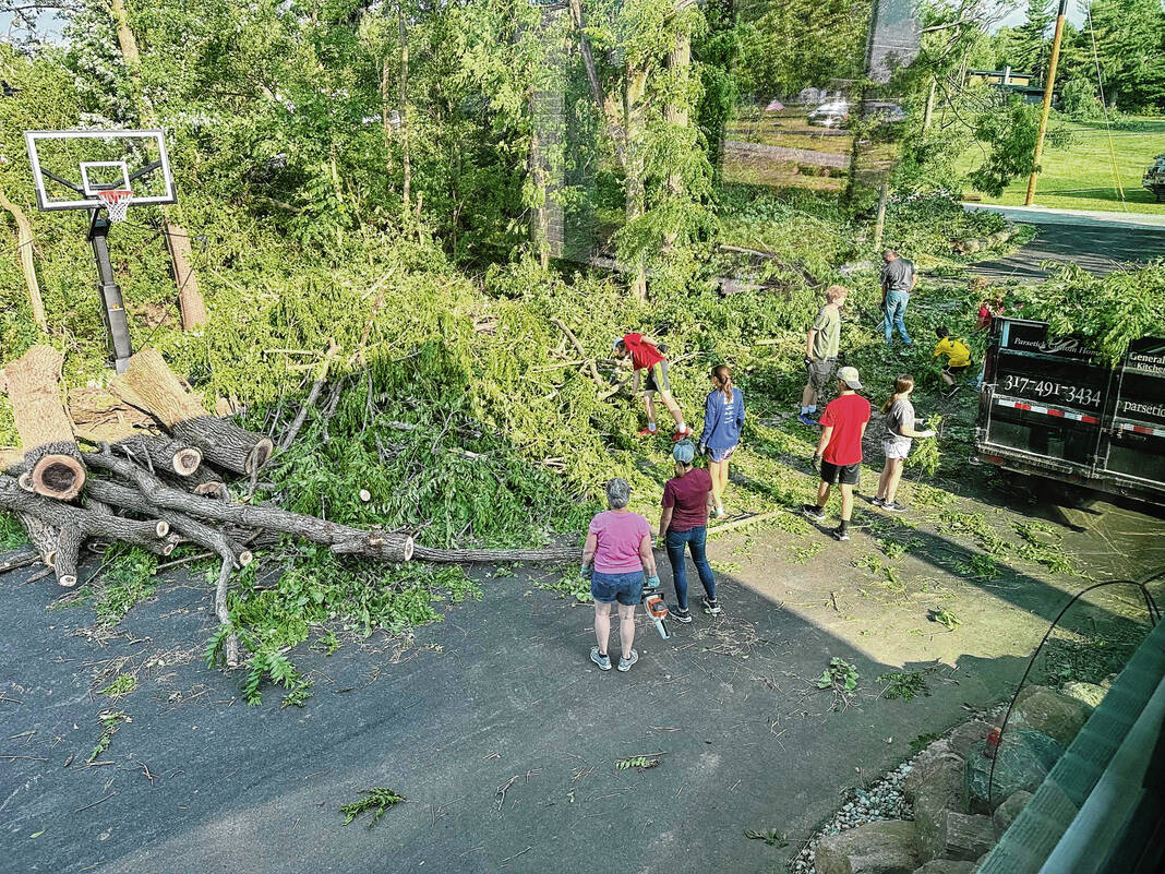
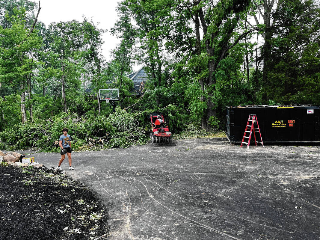
Clean up from Sunday’s tornado continues across areas of northern Johnson County, as officials discuss the storm’s path and peculiar timing.
The twister, now rated as an EF-2 with peak winds of 115 mph, was on the ground for 10 minutes, carving a 5.4-mile path of destruction through areas of White River Township and Pleasant Township. At its maximum width, the twister was anywhere from 200 to 400 yards wide, the National Weather Service said Monday.
Initially, the tornado was preliminarily rated as an EF-1 but was later upgraded by the NWS Monday evening after press time. Though the rating has been upgraded, it is still preliminary and could be updated if new information comes in, the agency said.
The NWS also confirmed three other tornadoes touched down in Indiana Sunday: one in Monroe County, one that traveled from Daviess County to Martin County and one in Martin and Dubois counties.
One death and one injury was reported from a tornado in Martin County. No deaths or injuries were reported anywhere else in Indiana — including Johnson County.


‘God blessed us’
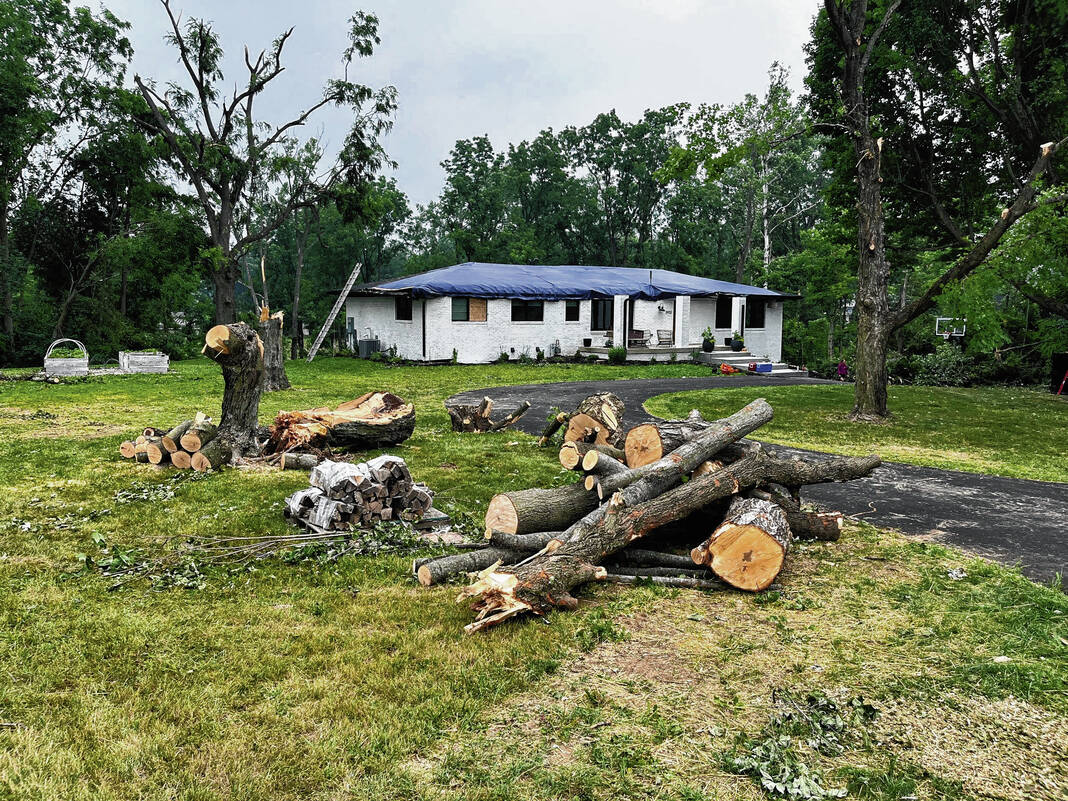
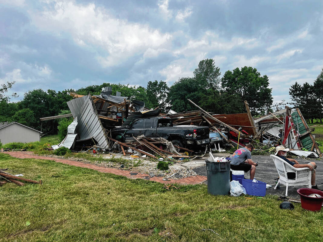
At the corner of Mullinix Road and Travis Road in Greenwood Tuesday, tractor motors whirred. Residents and family friends were picking up the pieces after Sunday’s storms brought destruction and frustration. For Deborah Wilson, the storm also strengthened her faith.
A neighbor came by on her bicycle on Tuesday afternoon, and the first thing she did was embrace Wilson. “We have been going around and looking at the damage, we just can’t believe it,” the neighbor said.
“I know, but it’s okay! At least we’re okay. God blessed us in sparing our lives,” Wilson said.
The storm lifted up their roof and discarded part of it nearby. Meanwhile, someone else’s roof was dropped by the tornado on their front porch Sunday evening. Deborah and her husband, Brian, were home, as well as their youngest son. They were in the basement when it happened, and she said she never expected she’d come out and see what all had happened.
“It’s surreal more than anything. I can’t believe it happened, but we’re blessed we’re all okay,” Wilson said.
The family’s home will need to be rebuilt, but all in all, they’re okay.
Path, damage detailed
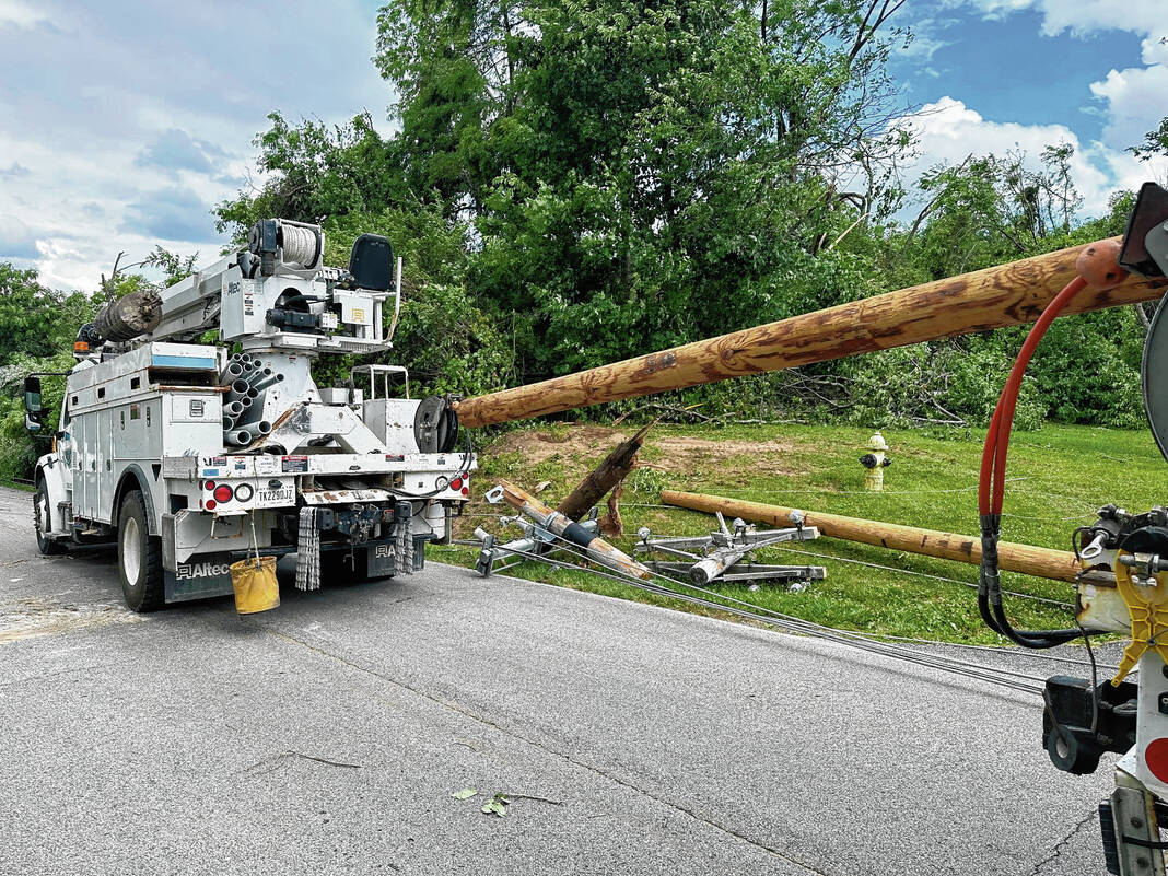
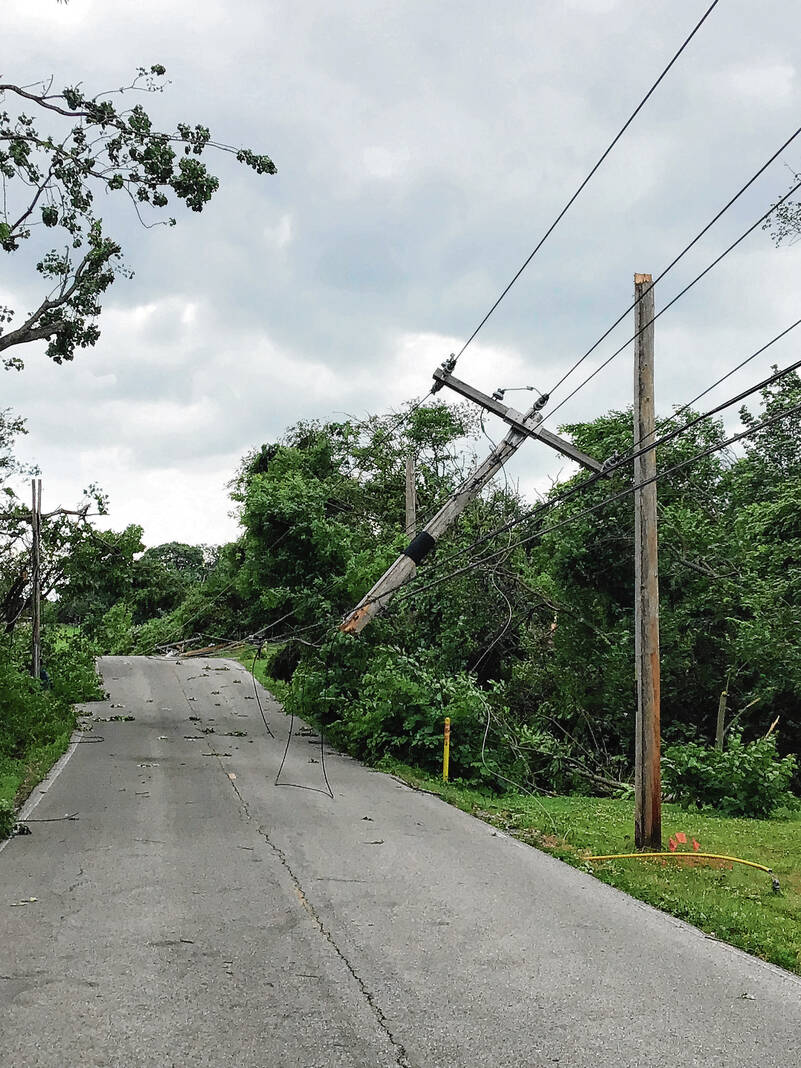
Sunday’s twister touched down at 4:13 p.m. just west of the intersection of Travis and Mullinix roads before moving east, intensifying quickly and causing damage to homes near the intersection. Damage included bricks blown off a large house, roof damage, snapped trees and a few snapped power poles, according to a public information statement issued by the NWS Monday evening.
In this area, the tornado was estimated to have winds of up to 110 mph — high-end EF-1 damage. However, meteorologists observed some low-end EF-2 damage in the area as well, with maximum winds of 115 mph estimated.
From here, the twister moved east through parts of the Kensington Grove subdivision with substantial roof damage to some homes and some trees downed and snapped. Winds of 95 to 110 mph were estimated here, according to the NWS.
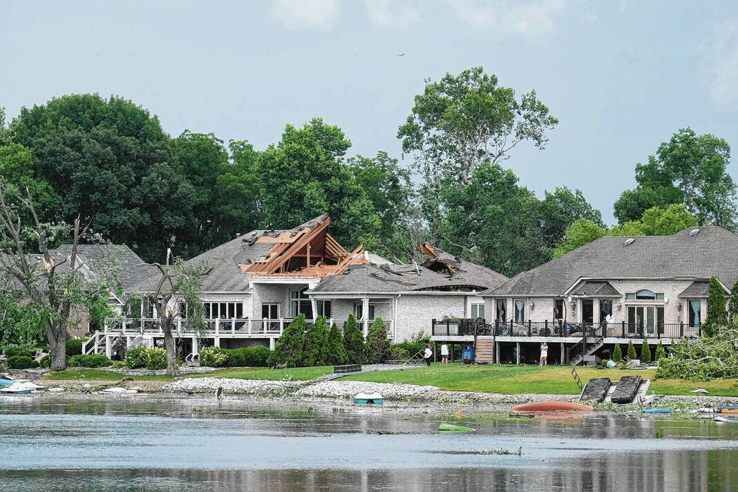
The twister then entered the Waters Edge neighborhood, traveling over the pond in the area with winds of about 90 to 100 mph, the NWS says.
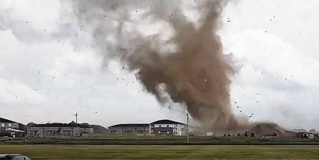
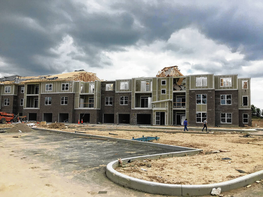
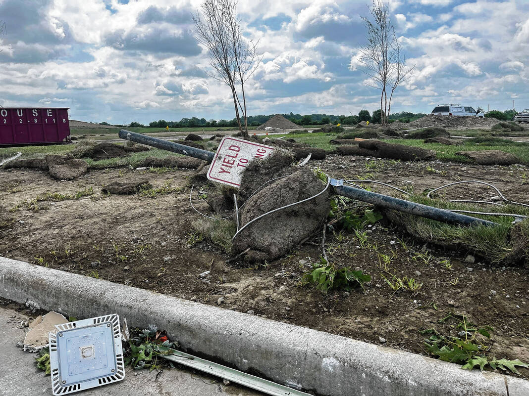
It continued past the Old Marsh on State Road 135, and just east of there it hit part of an under-construction apartment complex. One of the buildings in the complex had its roof torn off the length of the building, along with many broken windows and “even a few pieces of debris impaled into the ground.” Winds of about 115 mph were estimated here, the NWS says.
Turning southeast, the tornado passed over an open field where a narrow debris field was left behind. Meteorologists say the tornado may have skipped up and down a bit in this area.
After this, the twister came down and snapped and uprooted numerous trees along Tracy Road — just south of Restoration Church. More high-end EF-1 damage was found here, with winds estimated at 100 to 110 mph, the NWS says.
The tornado then lifted roughly a quarter or third of a mile southeast of this location — west of New Whiteland — at 4:23 p.m. Meteorologists say there was no further evidence of a tornado from that point on.

One confirmed tornado
Only one tornado is confirmed to have touched down in the county Sunday, though residents from Franklin, Whiteland and the area near the Worthsville Road interstate interchange in Greenwood took photos and videos of the twister, fast-moving clouds and other possible funnel clouds.
NWS meteorologists have seen the photos and videos too, but the evidence on the ground was consistent with only one tornado, said Ted Funk, meteorologist in charge of the Indianapolis Forecast Office. Funk was one of the meteorologists on the ground surveying damage in Johnson County Monday.
They went to damaged areas with emergency management officials to assess the damage using different indicators. From this, they can get good estimates of the tornado’s wind speeds as it passed through the area, and then use it to help get a final rating, Funk said.
After finishing the storm survey in Johnson County Monday, meteorologists looked over the information they gathered and looked at the storm on radar. Based on this analysis, they felt it was only one tornado, he said.
“It did go east, and then it turned southeast, but it was consistent with what the radar was showing,” Funk said.
Residents definitely could have seen multiple funnel clouds, but it’s possible they were looking at the same storm from different angles. Another possibility is there could have been other funnels that were occurring during the storm — but never touched down, Funk said.
It is also possible that a very weak tornado could’ve briefly touched down for a few seconds but did no damage. There has to be visible damage in order to substantiate the reports of a tornado, he said.
“We have to look at actual damage that has occurred,” Funk said.
There were some areas along the tornado’s path where it may have gone up into the sky before coming back down, which could have also made it look like multiple twisters. But for the most part, it had a pretty continuous path in the county, Funk said.
Local emergency officials also did not say anything to suggest there were multiple tornadoes, he said.


‘Unusual’ timing
Sunday’s EF-2 tornado was the third time in three months Johnson County has been hit by a tornado, but not the first time multiple tornadoes have struck the county in the same year.
On March 31, two twisters touched down in the county as part of a wide-ranging outbreak that spawned 145 tornadoes across the midwestern, southern and eastern United States. Locally, an EF-0 touched down near Bargersville taking down power lines and builidngs, while an EF-3 caused significant damage in Whiteland, damaging 179 homes and destroying 16.
Having two stronger tornadoes — an EF-2 and an EF-3 — touch down in the same county within the same year is not common. Most of the twisters to hit the county since 1950 have been EF-0 or EF-1 tornadoes, Funk said.
“Having an EF-2 and an EF-3 in the same year is a little bit more unusual,” he said. “… You had two tornadoes this year that were a little stronger than the ones that you’ve had in the past.”
Statistically, the county is on the lower end of tornadoes per year compared to other nearby counties. From 1950 to 2022, there were 20 tornadoes in Johnson County, while there have been 44 in Marion County and 34 in both Shelby and Boone counties, data shows.
“There’s other counties that have a little bit less than 20, but obviously, there’s counties that have more,” Funk said. “When we looked at the data, Johnson County didn’t stick out as some inordinate area where tornadoes are more prone to occur. It’s just kind of the luck of how storms move across central Indiana.”
Adding in the three from this year, there have 23 tornadoes in the county since 1950.
In the last 73 years, there have only been five years that saw two or more tornadoes in the same year for the county: 1956, 1992, 2010, 2015 and 2023. This year is the only year to have three and no other years have had more than that, data shows.
— This story is by Daily Journal reporter Noah Crenshaw and intern Ashlyn Myers.


