


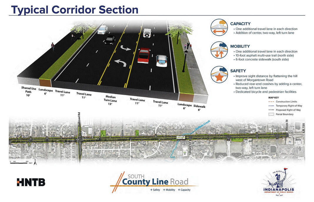
The proposed typical road section for County Line Road in the area where where crews plan to dig into a hill near Morgantown Road. Provided rendering
A project to expand County Line Road is moving forward after regulators approved an environmental review and officials responded to public comments from residents.
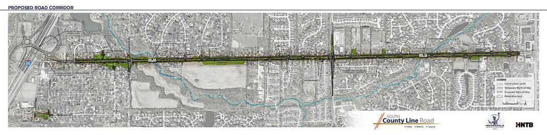
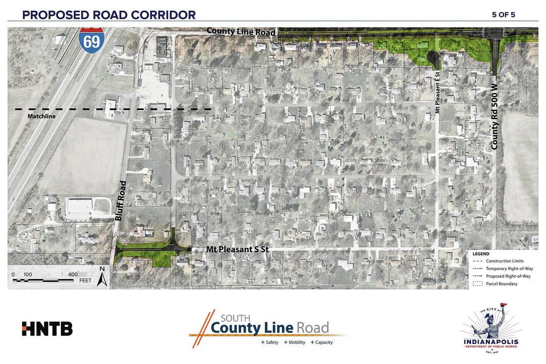
The South County Line Road Project will add travel lanes in both directions and a continuous center turn lane to County Line Road between Interstate 69 and State Road 135. Among the goals of the about $40 million project are to increase capacity and safety, along with adding a needed east-west corridor on the southside.
The city of Indianapolis is responsible for the approximately 2.3-mile-long project, with agreements made with both Johnson County and the city of Greenwood for portions that affect them. Indianapolis is funding the project, with assistance from federal dollars administered through the Indiana Department of Transportation.
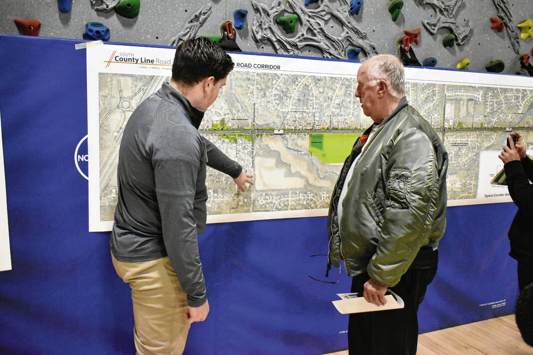
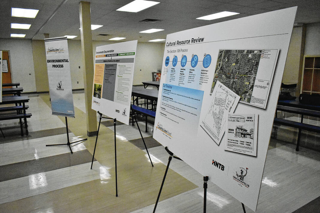
As part of the environmental analysis phase of the project, along with federal requirements, a public hearing was held on Nov. 30 in Indianapolis with officials from the city and HNTB, the engineering firm behind the project. A total of 71 people signed in for the public hearing, with 28 residents providing comments both in person and via email, mail or the project website during a public comment period from Nov. 15 to Dec. 15.
Both INDOT and the Federal Highway Administration have agreed the project poses “minimal impact” to the natural environment. A required environmental document, Approved Categorical Exclusion, was prepared and approved by officials on Feb. 6, allowing the project to move forward, HNTB Project Manager Chris Meador wrote in a legal notice announcing the project’s advancement.


The project
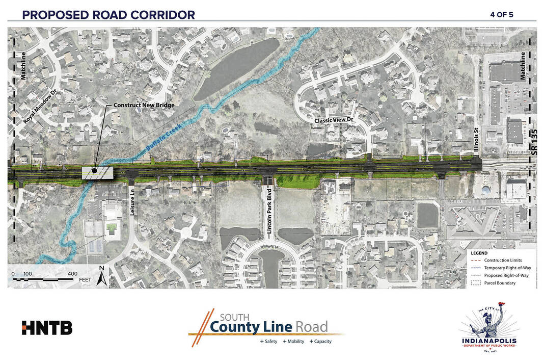
For the project, crews will construct an additional travel lane in each direction and a center left turn lane. They’ll also replace bridges over Pleasant Run Creek and Buffalo Creek, according to project documents.
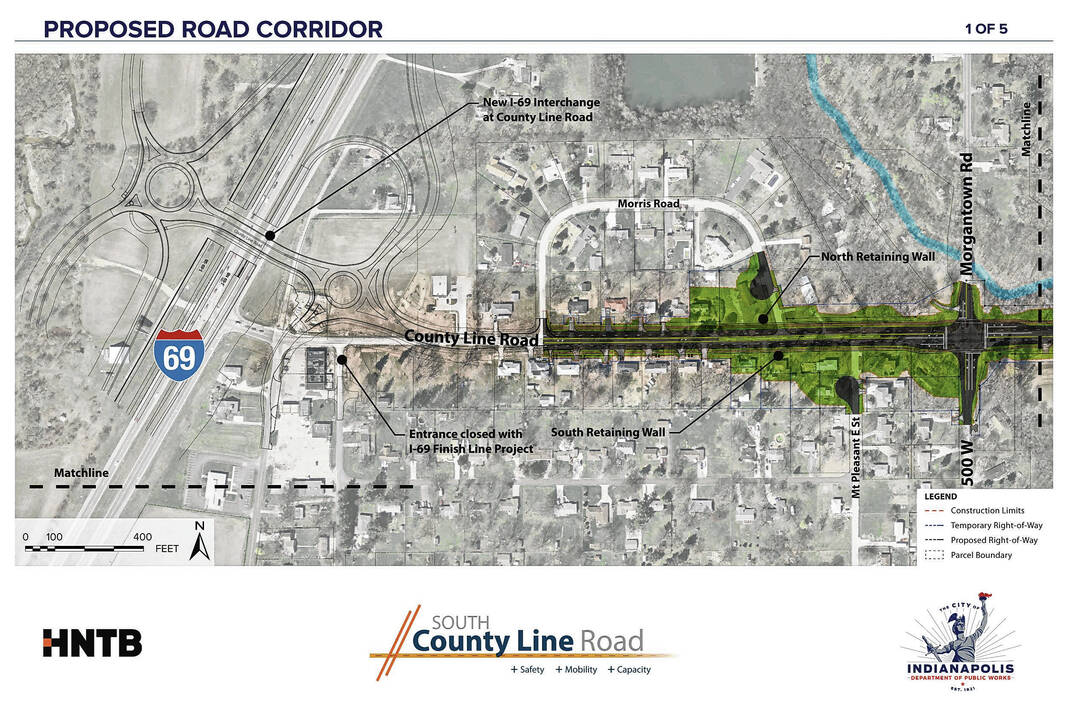
Safety will be improved by installing new traffic signals at Morgantown Road and Peterman Road/Railroad Road. West of Morgantown Road, crews plan to address a sight-distance issue caused by the slope of a large hill by digging into the hill to significantly reduce the slope. Retaining walls will be built on the north and south sides of the road in this area to minimize the impacts to adjacent property and steep side slopes, documents show.
On the Greenwood side, Mt. Pleasant East Street’s connection to County Line Road will be removed, turning it into a cul-de-sac. On the Indianapolis side, the easternmost Morris Road connection will be removed and converted into a cul-de-sac. Further south, an extension of Mt. Pleasant South Street will connect to Bluff Road, according to planning documents.
Construction crews will also improve pedestrian mobility on both sides of County Line Road by adding a new 10-foot wide multi-use trail on the Marion County side and a new 6-foot wide sidewalk on the Johnson County side. These new paths will make it safer for bicyclists, pedestrians and those who live in the neighborhoods nearby, Indianapolis officials previously said.
Drainage will also be improved throughout the corridor, documents show.
Officials respond
As part of the project process, engineers and officials were required to respond to the public comments given throughout the one-month comment period. A document uploaded to the project website details their responses to questions about traffic, safety, access, trails, landscaping and more, along with other public involvement efforts.
One resident expressed concern about traffic flow on Morris Road, with officials saying that the road will be designated as a non-through road and become a cul-de-sac. Another resident was concerned about making left turns onto the proposed five-lane road, and engineers responded by saying that left turns from intersecting streets would be simplified as the center lane would act as an “acceleration/merge preparation lane,” documents show.
The removal of mature trees for the project was also addressed. Because of the widening and the utility locations, “very few trees” within the right-of-way can be preserved, but officials will try to replant trees wherever possible and funds will be provided to the Indiana Department of Natural Resources for tree mitigation. Additional street trees will be planted within the project corridor or elsewhere within Indianapolis if possible, according to documents.
Several resident comments took aim at the proposed trails and bike paths, with some questioning their size. Indianapolis officials developed the project in accordance with a policy that requires an interconnected transportation system to accommodate all users, including pedestrians and bicyclists, documents say.

Indianapolis’ thoroughfare plan also indicates that four-lane arterial roadways should include a 10-foot shared-used path, officials said.
One resident asked why engineers chose to use signalized intersections instead of roundabouts. Alternative intersection types were evaluated, but based on information gathered, a signalized intersection was selected, officials said.
Additional turn lanes were also decided against based on traffic evaluations, documents show. A traffic study also showed that without the improvements, travel delays would be increased on the road because of the developments expected with the I-69 interchange.
County Line Road will also maintain a speed limit of 40 mph, officials said.
What’s next
With the environment review phase complete, the formal public involvement activities required for the federal approval process have been completed. Indianapolis officials plan to continue to share information about the project on its website, through an email list and through the mail as needed, Meador said.
The approved environmental document is also available on the project’s website, SouthCountyLineRoad.com, and by request, she said.
Officials will advance the project to the next phase with tree clearing and utility relocation starting this month, with construction anticipated to start in 2025, Meador said.

