

If last year is any indication, severe weather preparedness is more important than ever for Johnson County residents.
Indiana Gov. Eric Holcomb has proclaimed March 10-16 as Severe Weather Preparedness Week. Officials’ goal is to better educate people about the hazards of severe thunderstorms and tornadoes and to help everyone be prepared when severe weather occurs.
Johnson County experienced these hazards first-hand last year.
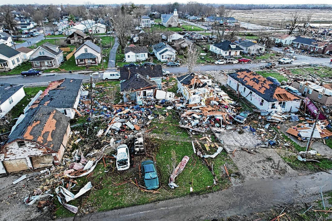
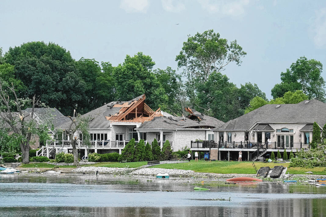
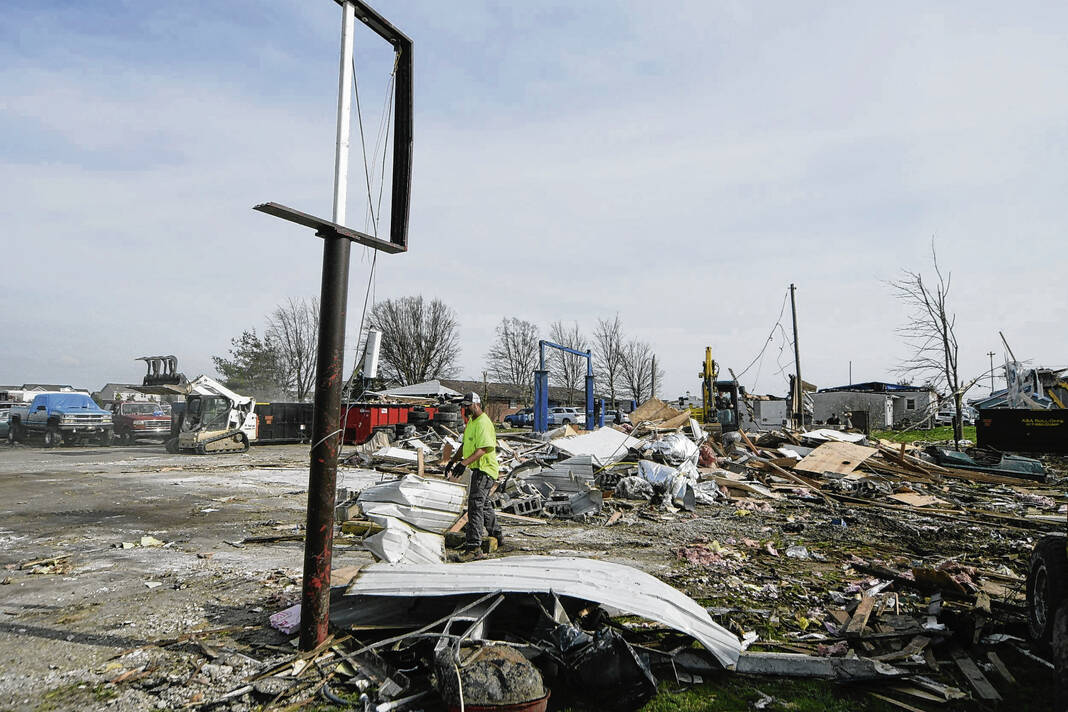
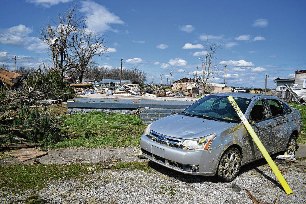
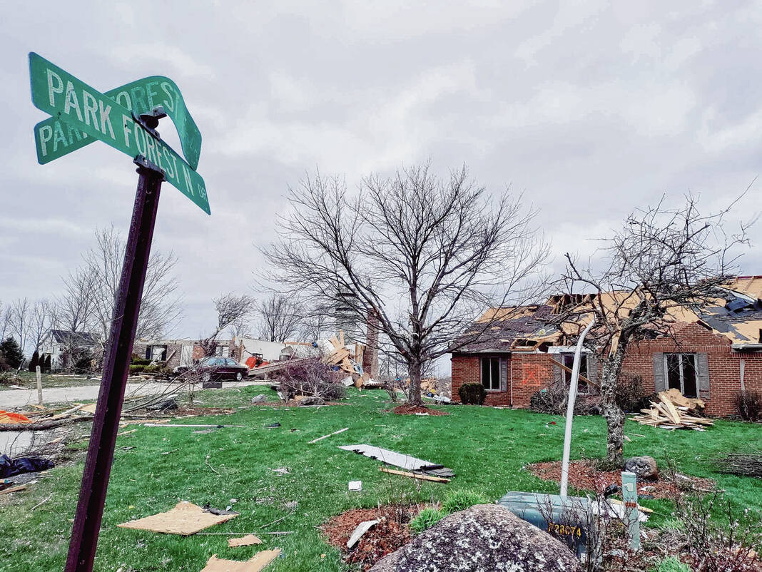
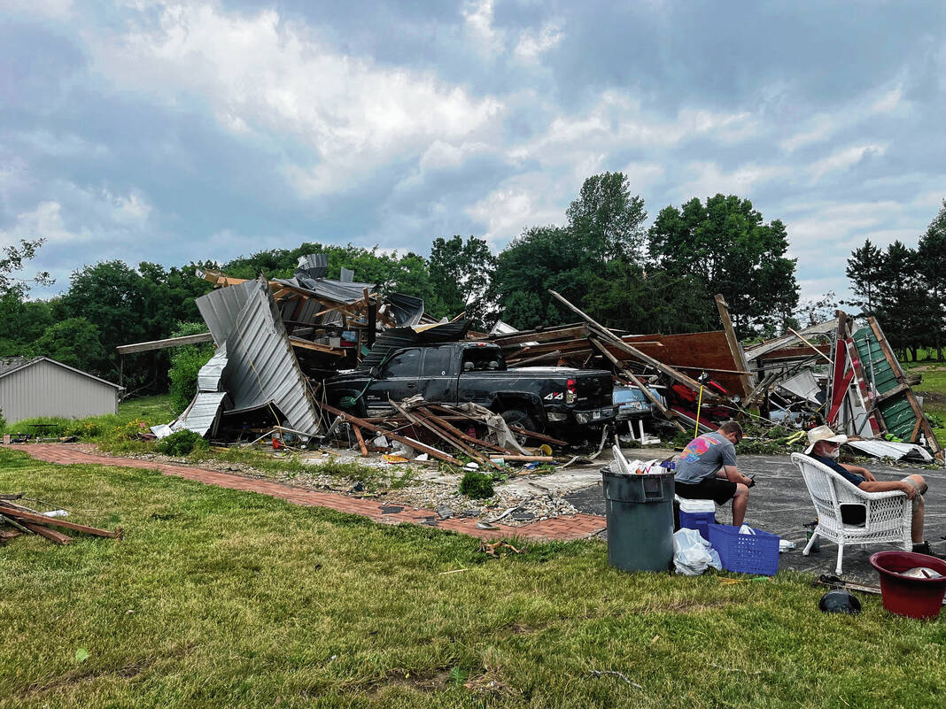
Two tornadoes touched down the night of March 31, 2023: a brief EF-0 in rural Union Township and an EF-3 that caused destruction throughout the heart of Whiteland, damaging 179 homes and businesses. Straight-line winds also caused damage in other areas of the county, including Franklin.
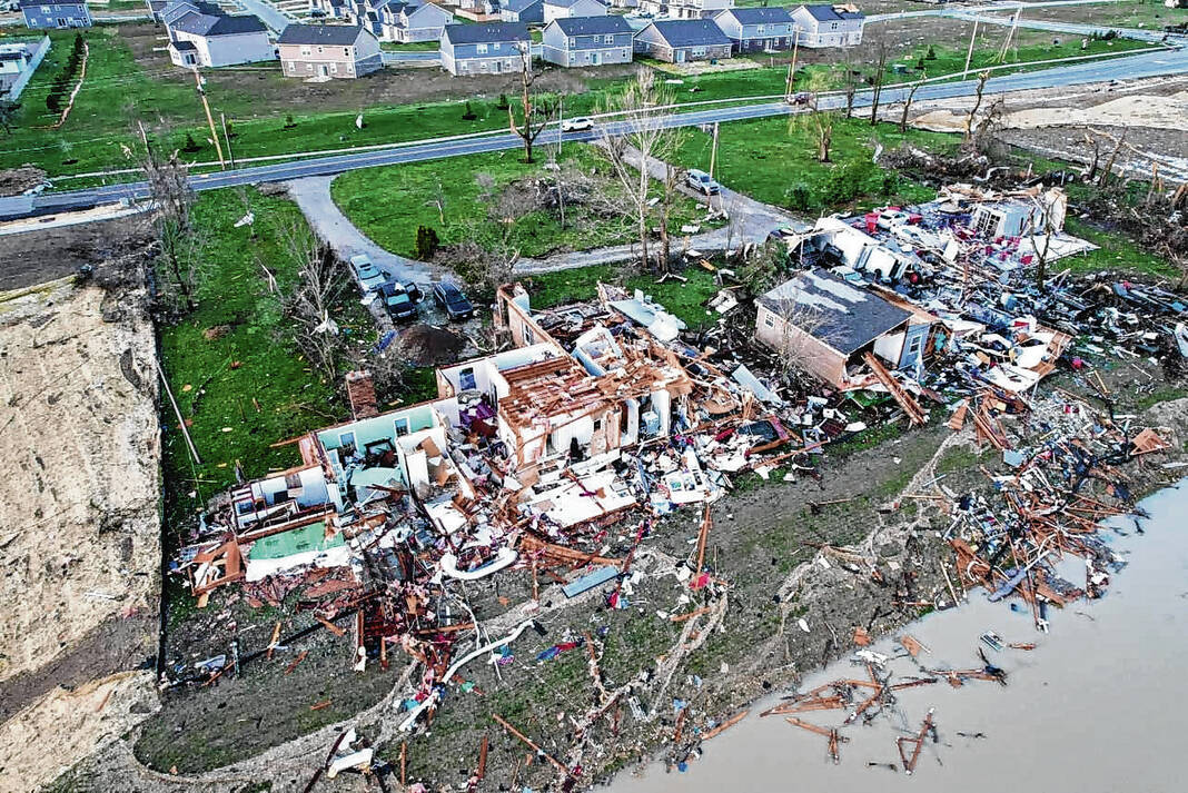
Nearly four months later, the county was again impacted by a tornado. Another EF-3 touched down on June 25, carving a path of destruction from Mullinix and Travis roads in White River Township to Tracy Road in New Whiteland.
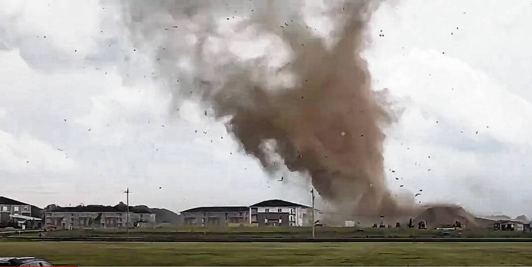
Severe weather was a defining mark of 2023 for Indiana, meteorologists previously said. The state set a record for the second most tornadoes on record for a single year with 54, according to the National Weather Service.
Plan ahead
Before storms arrive, Hoosiers can take steps to reduce risks by checking weather forecasts daily and planning outdoor activities to be near a secure shelter if storms are possible. Hoosiers can also put pets indoors ahead of time and park your vehicle in a covered area to avoid damage from hail or debris, according to the Indiana Department of Homeland Security.
Paying attention to thunder is also important. Thunder is caused by lightning, and when it is heard from a nearby storm, the lightning is within 10 miles and could strike someone. Hoosiers should seek shelter until at least 30 minutes after the last sound of thunder, according to IDHS.
Making a plan of where to take shelter or evacuate, along with keeping an emergency disaster kit at all times is also helpful. Kits should include three days worth of non-perishable food and water, a gallon of water per person per day, extra batteries and a battery-powered radio. They should also have flashlights, medicine and medical items, along with other personal hygiene items, Johnson County Emergency Management Director Stephanie Sichting told the Daily Journal last year.
Having multiple ways to get warnings is also recommended by public safety officials. Residents should not rely on outdoor sirens to be alerted if there is a tornado warning, as they are designed to be heard outdoors — not indoors.

In Johnson County, outdoor storm sirens are activated by the county’s Public Safety Communications Center. They only sound when the National Weather Service issues a tornado warning, or when trained weather spotters or public safety personnel see a funnel cloud or tornado.
All sirens in the county will be activated, even if the weather service issues a tornado warning for a specific area of the county, according to the policy.
Other ways to get warnings include weather radios, weather apps, TVs and more, officials say.
Knowing the difference between watches and warnings is key too. Watches cover large areas and usually are issued “hours” ahead of severe weather, while warnings cover small areas and are usually issued “minutes” ahead, according to the weather service.
The NWS uses tacos as an analogy for the difference between watches and warnings. A “Taco Watch” would mean the ingredients for tacos are present but they are not yet assembled. A “Taco Warning” means tacos are ready to be served or are currently being eaten.
What to do
When storms do come, the weather service recommends you ‘Get In, Get Down and Cover Up’:
- GET IN: When outside, get inside. If already inside, get as far into the middle of the building as possible.
- GET DOWN: Get underground if possible. If that is not possible, go to the lowest floor in the building.
- COVER UP: Flying and falling debris are a storm’s number one killer. Use pillows, blankets, coats, helmets, etc to cover up and protect the head and body from flying debris.
It’s not just the wind that could cause damage, flooding can too. On average, flooding is the deadliest thunderstorm-related hazard but it is often overlooked, according to the National Weather Service.
The majority of flood deaths are preventable and occur as a result of people driving into flood waters, meteorologists say. As little as two feet of water can cause most cars to float, so officials ask drivers to play it safe and turn around.
Floodwaters can also contain hazards such as waste and contaminants, downed power lines, vehicles, signs and trees. Even a few inches of swift-moving water can knock an adult over, so people should try to find alternate routes, IDHS says.
People should also make sure they have flood insurance, as standard homeowner’s and renter’s insurance policies do not include it. To learn more about flood insurance, go to in.gov/floodinsurance.
To see more preparedness tips, go to weather.gov/ind/SevereWxWeek or in.gov/dhs/get-prepared/nature-safety/severe-weather-preparedness/.


